
Articles
Archive
- June 2026
- May 2026
- April 2026
- March 2026
- February 2026
- January 2026
- December 2025
- November 2025
- October 2025
- September 2025
- August 2025
- July 2025
- June 2025
- May 2025
- April 2025
- March 2025
- February 2025
- January 2025
- December 2024
- November 2024
- September 2024
- August 2024
- July 2024
- June 2024
- May 2024
- April 2024
- March 2024
- February 2024
- January 2024
- December 2023
- November 2023
- October 2023
- September 2023
- August 2023
- July 2023
- June 2023
- May 2023
- April 2023
- March 2023
- February 2023
- January 2023
- December 2022
- October 2022
- August 2022
- July 2022
- June 2022
- May 2022
- April 2022
- March 2022
- February 2022
- January 2022
- December 2021
- November 2021
- October 2021
- September 2021
- August 2021
- July 2021
- June 2021
- May 2021
- April 2021
- March 2021
- February 2021
- January 2021
- December 2020
- November 2020
- October 2020
- September 2020
- August 2020
- July 2020
- June 2020
- May 2020
- April 2020
- March 2020
- February 2020
- January 2020
- December 2019
- November 2019
- October 2018

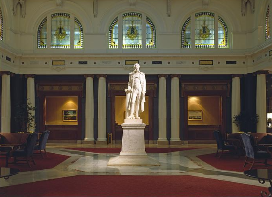
Mount Rushmore – a monument to surveyors
On our 250th anniversary, it’s a great time to remember those who led the creation of the great American Experiment. Four of our key presidents are immortalized at Mount Rushmore, where the birth of our nation will be celebrated by surveyors on October 19, 2026 with the installation of a commemorative marker crafted by Berntsen and sponsored by the National Society of Professional Surveyors (NSPS)

Summer Solstice – key to ancient surveying
Summer solstice has been an important day since people inhabited the earth. On Sunday, June 21st, many cultures will be celebrating summer solstice with rituals and festivals. In ancient times, summer solstice was more than a day for celebration – it was key to understanding the world.

National Trails Day
June 6 is National Trails Day®. The United States has more than 200,000 miles of trails, stretching across national parks and forests, state reserves and municipal lands. The trails are managed by federal, state, and local agencies, as well as thousands of private organizations.
Honoring surveyors who served
For more than 250 years, the capable hands of surveyors have played a key role in building and defending our country. From the colonial surveyors turned patriots [list of blog links to those surveyors], to the intrepid explorers of the Louisiana Purchase, surveyors were key to the founding of our nation.
Public Works:
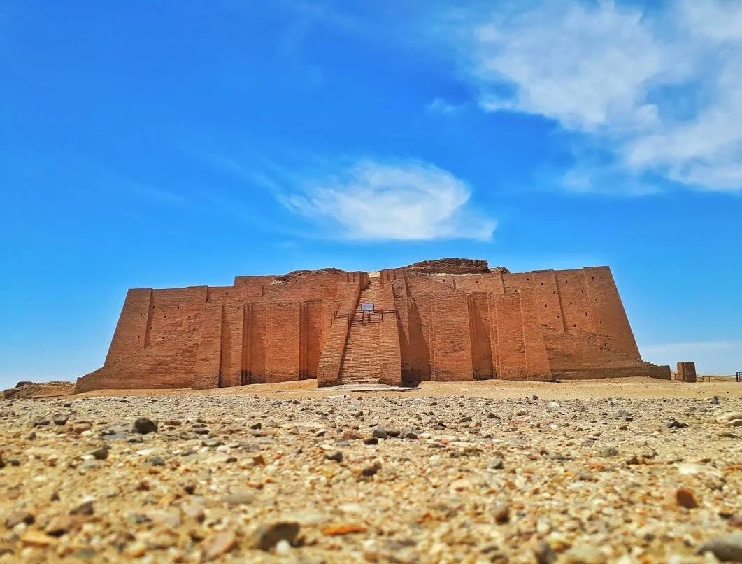
Public works have sustained civilizations for more than 6,000 years.
Mesopotamia (specifically the Sumerians) is widely recognized as the first civilization to develop extensive public works, starting around 4000 BCE.

The Digital Twin Needs a Physical Body
In boardrooms across the country, the "Digital Twin" is often discussed as a shimmering, 3D oracle, a virtual replica of our assets that can predict the future, optimize workflows, and save millions. But today a critical reality has set in: A digital twin without a verified physical body is just a ghost.
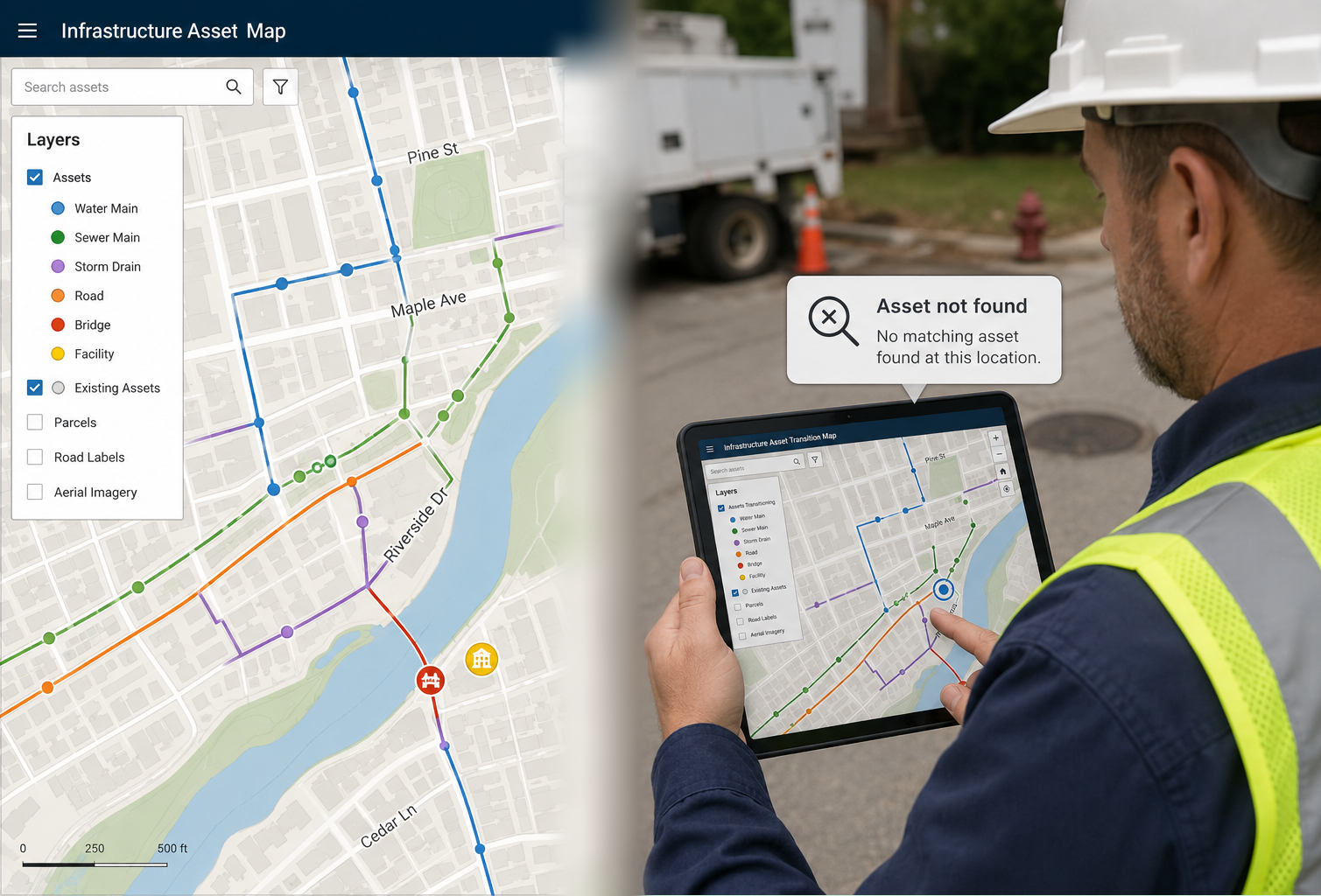
Feeding the Beast:
In the world of modern infrastructure, GIS (Geographic Information Systems) is the "beast" that powers every major decision. From predicting main breaks to optimizing snowplow routes, your GIS is the brain of your operation. But a brain is only as good as the information it receives.
From Brass to Bytes:
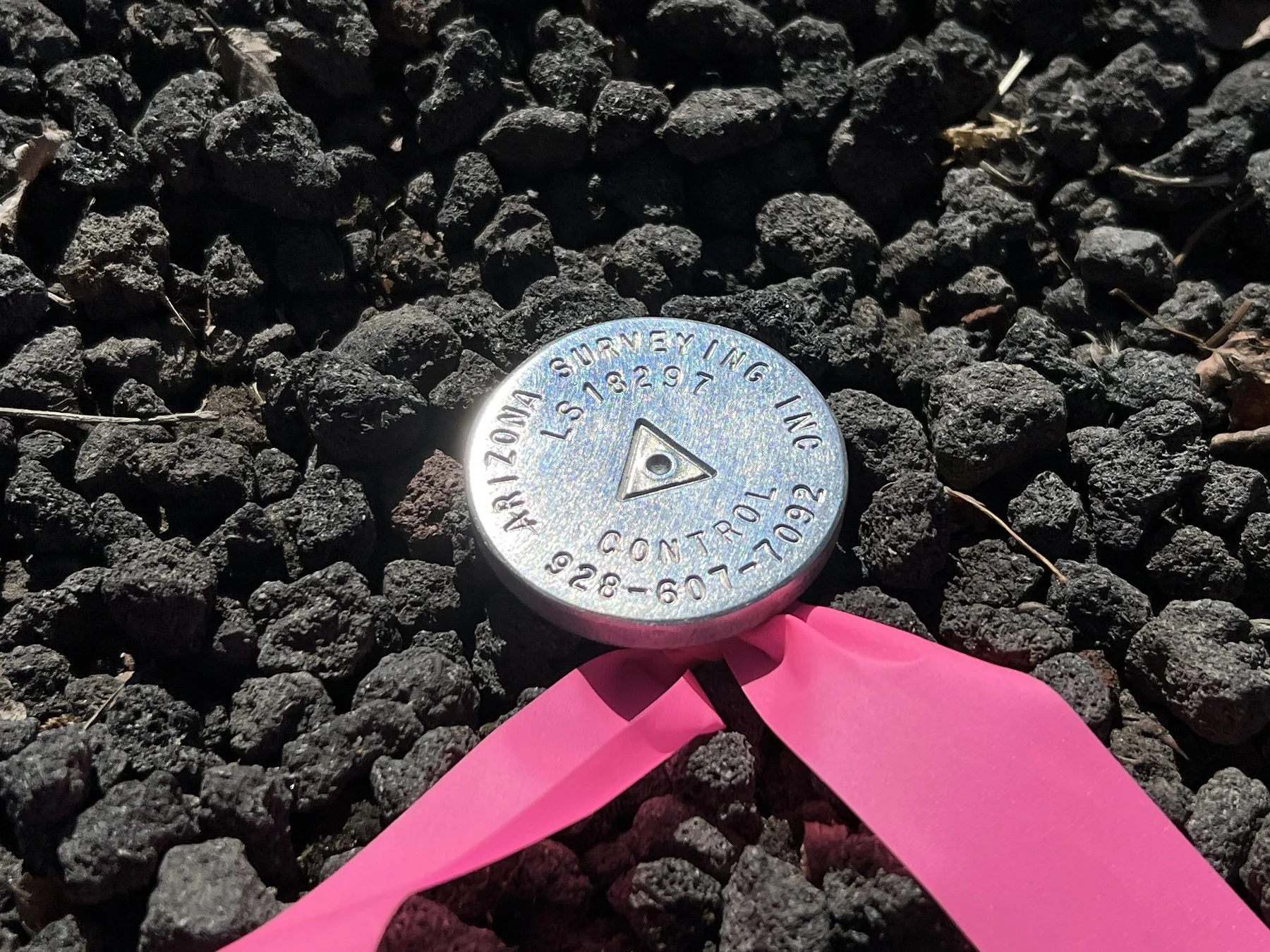
For more nearly 55 years, Berntsen International has been the silent guardian of the world’s boundaries. Since our founding in 1972, we have perfected the physical marker; moving from heavy, corrosive monuments to the lightweight, metallurgical-matched brass and aluminum markers that now define modern surveying.

The "Final As-Built" That Actually Lasts
In the world of civil engineering and land surveying, the "As-Built" is intended to be the definitive record of truth—the final word on where an asset lives and how it was constructed. Yet, as any seasoned surveyor knows, traditional as-builts often begin to "drift" from reality the moment the construction crew leaves the site.
Thomas Jefferson, surveyor, born April 13, 1743
Thomas Jefferson was an accomplished surveyor and mapmaker. He was born April 13, 1743 on his father's plantation of Shadwell located along the Rivanna River near the Blue Ridge Mountains of colonial Virginia.
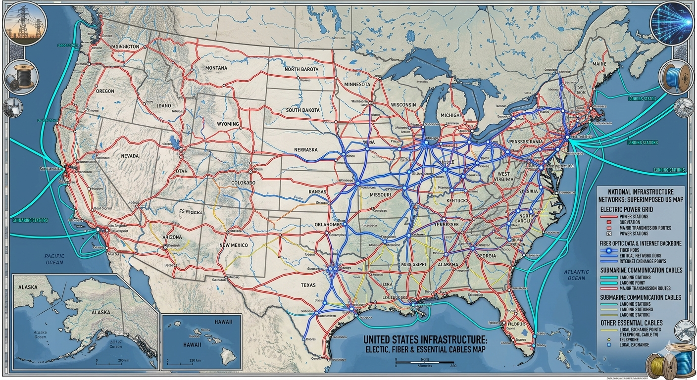
April is safe digging month
More than 180 million miles of electrical, telephone, and cable lines crisscross the United States[1]. More and more new developments are “undergrounding” cables to improve aesthetics and improve resilience during intense weather.
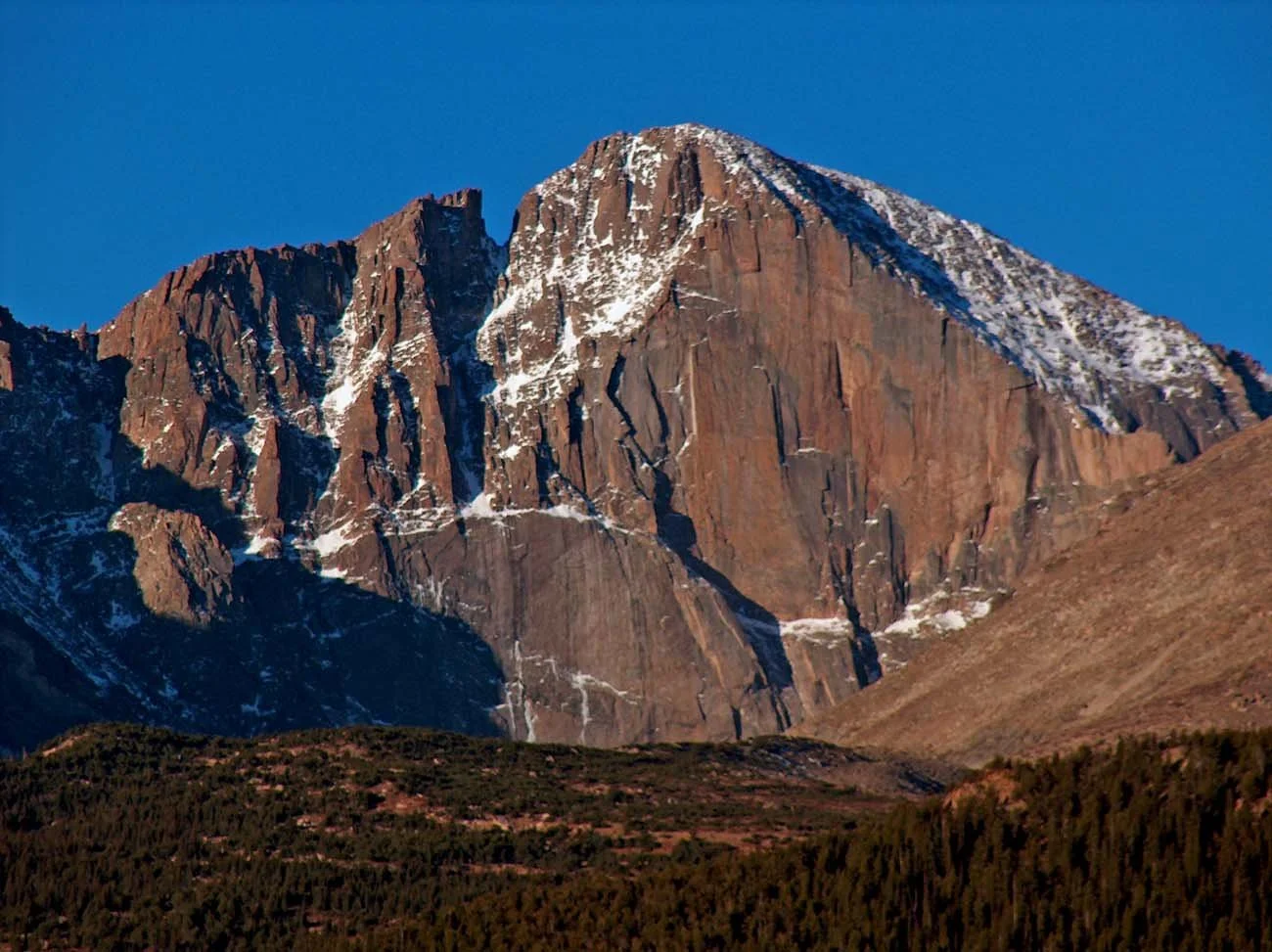
Stephen H. Long - an officer, a surveyor and much more
Trappers, fur traders and riverman are known for exploring the West and opening it to settlement. Since the founding of the Army Corps of Engineers in 1802, the Corps has fielded a hard-working, highly trained cadre of surveyor-explorers who were instrumental in opening up the West to immigration.

What Makes a City "Smart"?
Walk through many major metropolitan area today, and you’ll see the hallmarks of the future: electric vehicles, Waymos (self-driving cars), charging stations and autonomous delivery robots. But if you ask a City Manager or a Public Works Director what truly makes a city "smart," they won’t point to the gadgetry on the sidewalk. They’ll point to the data buried beneath it.
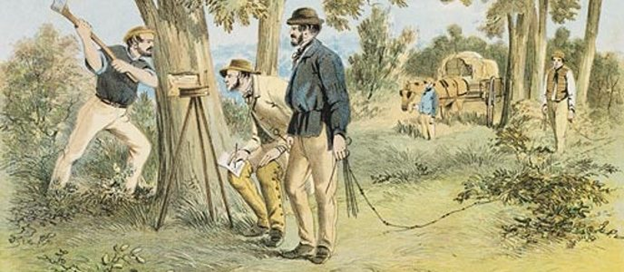
It’s National Surveyor’s Week
This week, we recognize a profession that has been instrumental in the growth of our country. Land surveying is an on-going, massive project that has mapped more than 1.5 billion acres of public land since the late 18th century, primarily using the Public Land Survey System (PLSS). During Colonial times, surveyors (including Thomas Jefferson) used the system of metes and bounds, which relied on measuring distances between geographic features such as rocks, trees and so on. Later on, surveyors used a grid system developed by Jefferson, to map the vast territories west of the original 13 colonies.
The Unmovable Boundary:
In land development, the "Property Line" is a theoretical concept with a very physical requirement. It demands that a specific point on the earth remains fixed, regardless of the environment.
But in many regions - particularly coastal areas, wetlands, or new fill sites - the ground itself fights against this permanence.
Design Starts in the Dirt:
We live in the era of the Smart City. Architects design in Revit, Urban Planners simulate traffic flows in ArcGIS, and Engineers build Digital Twins that model every pipe and wire.
But these multi-million dollar models suffer from a critical vulnerability: They assume the ground stands still.
It doesn't.
The Anchor of Accuracy
In modern infrastructure, we talk endlessly about the cloud. We discuss LiDAR point clouds, drone photogrammetry, and real-time GIS updates. It is easy for a VP of Operations or a Chief Engineer to believe that the physical world is becoming secondary to the digital model.
This is a dangerous misconception.

Terminalia - the immovable deity
According to legend, the first shrine to Terminus, the Roman god of boundaries, was established by Romulus circa 723 BC at the founding of Rome. Two hundred years later, the shrine was found to be immovable when the first king of Rome wanted to move it to rebuild the Temple of Jupiter

From Land Surveys to Digital Twins:
Back in colonial times, land surveying was an essential skill. Under British rule, the land claimed by the Crown belonged to the King. The only way it passed into the hands of other people was through grants or outright sales from Crown to businesses or individuals.