RFID Cuts Through the Clutter
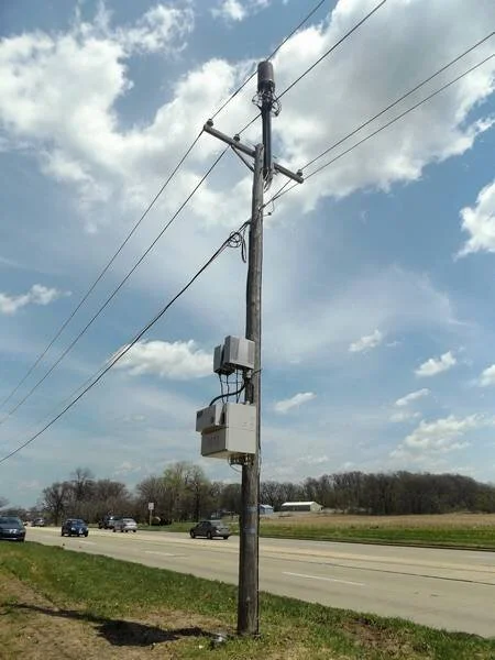
Many assets, including utility valves in Right of Ways, fire hydrants across a city, and utility poles are engaged by multiple departments, contractors and customers outside of the utility owner.
Sharing precise information between entities is essential but is fraught with difficulties and regulatory considerations. First, there are many governing laws about what type of information can be shared, due to national security directives, data privacy regulations, joint use agreements and a range of regulatory rules, depending on the utility. Additionally, utilities are continually innovating and have many internal safeguards in place to prevent sharing of proprietary information. All of these rules have legal implications and therefore represent additional risk to the utility.
Aside from bureaucratic hurdles, sharing information can be technically challenging as well. Many utilities retain paper records that have not been migrated to digital platforms. Not all digital platforms are compatible, making sharing information more difficult.
An intractable problem?
With all these obstacles, it’s amazing that utilities can get anything done when their operations overlap. Back in 1990, two Georgia utilities created a consortium, called The National Joint Utilities Notification System (NJUNS) that developed an online ticketing system that focused on shared use of utility poles. Today, this system has been expanded to more than 30 states and also includes shared trenches as well.[1]

Unfortunately, NJUNS only covers certain types of utilities for specific assets. Fortunately, more and more utilities have adopted Geographic Information Systems (GIS) that link specific utility asset data to location. With GIS, utilities can export specific, shareable data to another utility or contractor when needed. GIS has the potential to greatly improve data sharing. Unfortunately, at this time, GIS often doesn’t include every asset and information about the asset may be incorrect or incomplete.
GIS and RFID to the rescue
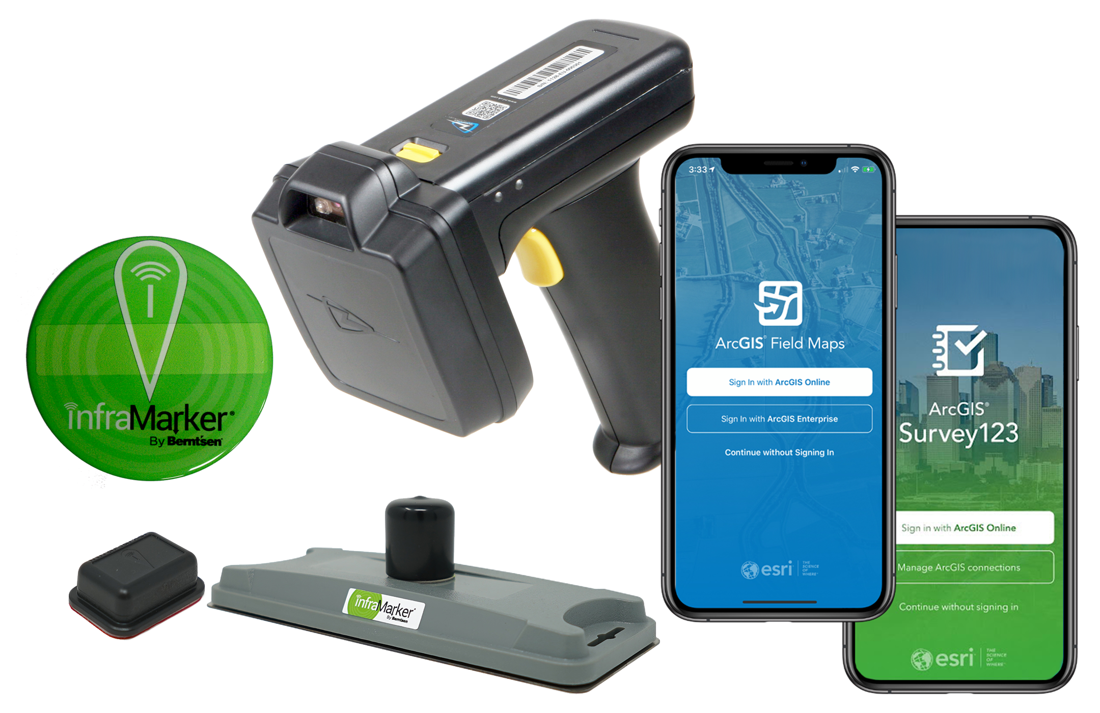
That’s where RFID is the game-changer for the usability of GIS for managing assets within and across organizations. RFID starts with the asset itself. Assets marked with RFID tags render the asset immediately identifiable with a simple scan, delivering a universal serial number and descriptor that supports asset identification and a small amount of additional information approved by the asset owner. Anyone with the InfraMarker RFID app on their phone can read the RFID tag and know who to contact regarding the asset. This quickly eliminates on-site confusion – but the real value of RFID is long-term asset management when used with GIS. When RFID tags are connected to GIS, approved users can access the full history of any specific asset and launch workflows applicable to that asset. Additionally, GIS administrators can give access to select data to other users, such as contractors and other utilities as needed.
RFID provides clarity in situations where collaboration is essential. Utilities walk a fine line when balancing the need to share data while protecting their business. RFID and GIS are key to ensuring that data is verifiable, accurate and limited to necessary information.

An additional benefit, native to RFID, is that no line of sight is needed to read a tag. This means that even buried assets can be identified with a scan – essential for excavation in brown field environments. Considering that unintended utility strikes cost more than $30 billion annually in the United States[2], verification with RFID is a simple step that could prevent construction delays and save money.
The InfraMarker RFID Advantage
InfraMarker RFID is native to ESRI’s Survey123 and Field Maps mobile apps
InfraMarker RFID works with the world’s standard UHF, NFC, and PIT RFID tags, regardless of manufacturer.
InfraMarker Certified Tags are guaranteed to have unique ID numbers, support easy field identification, and enhance RFID interrogation data sharing between organizations
InfraMarker is a product line of Berntsen International, a respected manufacturer of survey and infrastructure marking products since 1972
Benefit: Improved asset management across the value chain, in-field human readable asset identification by any user* *with InfraMarker certified tags and software
Learn more about how InfraMarker can cut through the clutter in your project. Give us a call today!