Mount Rushmore – a monument to surveyors
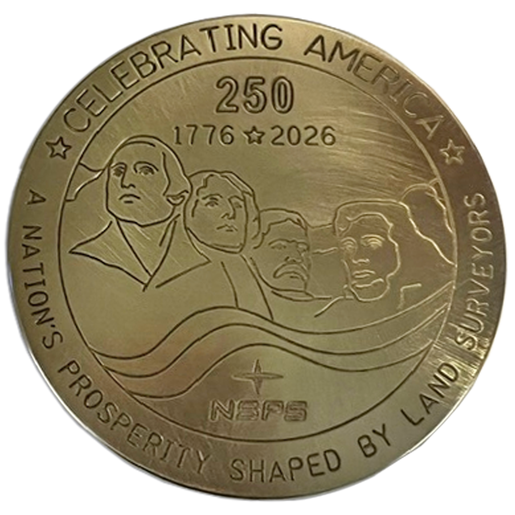
Commemorative NSPS 250th anniversary medallion featuring the design used on the 12-inch marker to be installed at Mount Rushmore.
On our 250th anniversary, it’s a great time to remember those who led the creation of the great American Experiment. Four of our key presidents are immortalized at Mount Rushmore, where the birth of our nation will be celebrated by surveyors on October 19, 2026 with the installation of a commemorative marker crafted by Berntsen and sponsored by the National Society of Professional Surveyors (NSPS). This celebration is especially fitting because these men were not just exceptional leaders, they were also surveyors and map-makers.
George Washington, leader and strategist of the Revolutionary War and our first President
Thomas Jefferson, author of the Declaration of Independence and the Public Land Survey System (PLSS)
Teddy Roosevelt, established the US Forest Service and created hundreds of national parks and reserves.
Abraham Lincoln, led us through a Civil War and authored the Emancipation Proclamation
How it all began
#/media/File:Declaration_of_Independence_(1819),_by_John_Trumbull.jpg)
John Trumbull's painting, “Declaration of Independence,” depicting the five-man drafting committee of the Declaration of Independence presenting their work to the Congress.
The United States was neither founded as a pure republic nor as a pure democracy. Rather, the Framers of the Constitution believed that a mixed government, containing both republican and democratic features, would be the most resilient system.[1]
The men who developed the US Constitution and the Bill of Rights drew from their classical education by incorporating the democratic ideals of ancient Greece with contemporary ideas, such as the separation of powers derived from the French Enlightenment. Additionally, native governments, such as the Iroquois Confederacy, influenced the crafting of the constitution by its use of federalism and representative democracy. Federalism divides power between a central government and individual states or tribes, and representative democracy provided the idea that elected leaders would represent the people in council.
Monumental men

Map created by Peter Jefferson, Thomas Jefferson’s father. Fry, J., Jefferson, P. & Jefferys, T. (1755) A map of the most inhabited part of Virginia containing the whole province of Maryland: with part of Pennsylvania, New Jersey and North Carolina. Retrieved from the Library of Congress.

Lithograph of Lincoln the Surveyor by Lloyd Ostendorf, 1967, courtesy of the Indiana State Museum and Historic Sites.
Surveying was key to our developing nation. Before the revolutionary war, the Crown relied on surveyors to parcel out the land for sale, speculation and for rewarding loyal subjects. They also relied on surveyors to create accurate maps for defense purposes, since the competing French and Spanish monarchies both had imperialistic designs on the continent.
As time went by, it became clear that the extortionary British monarchy was not going to work in the New World, and many surveyors became American patriots supporting the Revolution, including:
Benjamin Bannaker – A gifted scientist, surveyor and astronomer, Bannaker was friends with Andrew Ellicott who hired him as an engineer surveying the land that would become Washington, D.C. He used celestial observations and did complex mathematical calculations to create accurate maps of the area.
Richard Caswell – At age 17, appointed the apprentice to the Surveyor General of North Carolina. He later studied law and represented North Carolina at the First Continental Congress. During the War, he commanded the Minuteman region around New Bern, North Carolina. As Governor, his skill in negotiations actually prevented a regional war.
Abraham Clark – Gifted in mathematics, Clark applied that knowledge to surveying. He built a reputation as a plain-spoken and clear-thinking leader and was one of New Jersey’s delegates to the Continental Congress. He signed the Declaration of Independence – when the British were stationed across the river from his home.
William Crawford – Mentored a young Washington who had just been appointed as surveyor of Culpeper County in Virginia. He later served with Washington through many battles.
Andrew Ellicott – A science-loving farmer and mill-owner, Ellicott also had a thriving surveying business and was a commissioned officer in the Continental Army. Later, he was commissioned to lead the survey of the new federal city of Washington DC.
Robert Erskine – Appointed by Washington as the first Geographer and Surveyor-General to the American Army. He and his team created and delivered more than 200 maps and surveys to Washington during the War, profoundly influencing its outcome.
Christopher Gist – Surveyed the city of Baltimore; fought alongside George Washington and saved Washington’s life – twice
Stephen Hopkins – Hopkins was named as one of two Rhode Island residents to the First Continental Congress in 1774. He signed the Declaration of Independence and served in the Continental Congress.
John Morton – Taught surveying by his step-father, Morton became a farmer, lawyer and Pennsylvania politician. His was the key vote that passed the Declaration of Independence.
Roger Sherman – a self-taught surveyor, member of the First Continental Congress and signer of all four founding documents: The Continental Association, The Declaration of Independence, The Articles of Confederation and the US Constitution.
The legacy continues
For 250 years, surveyors have played a vital role in the growth and development of the United States. From establishing property boundaries and mapping the frontier to supporting the infrastructure that connects our communities today, the surveying profession has helped transform a young nation into the country we celebrate today.
The USA 250 commemoration at Mount Rushmore honors this legacy. Against the backdrop of one of America's most iconic landmarks, surveyors and industry leaders will gather to recognize the profession's enduring impact on freedom, progress, and the American landscape. Berntsen is honored to contribute to this historic event by creating the commemorative marker that celebrates the surveyors who have helped define and build our nation for the past two and a half centuries.
Get your commemorative brass medallion.