What Makes a City "Smart"?

Walk through many major metropolitan area today, and you’ll see the hallmarks of the future: electric vehicles, Waymos (self-driving cars), charging stations and autonomous delivery robots. But if you ask a City Manager or a Public Works Director what truly makes a city "smart," they won’t point to the gadgetry on the sidewalk. They’ll point to the data buried beneath it.
A truly Smart City isn’t defined by its front-facing tech; it’s defined by its digital intelligence—the ability to know exactly where every asset is located, its current condition, and its maintenance history, down to the inch.
The $3.7 Trillion Opportunity

The shift toward "intelligent urbanism" is accelerating at a staggering pace. Recent market analysis from Grand View Research projects the global smart city market will reach $3.7 trillion by 2030, growing at a compound annual rate of nearly 30%.
This massive investment isn't just for show. It is a response to a critical reality: as urban populations swell, traditional "analog" infrastructure management is no longer sustainable.
The Data Gap: Estimates suggest that only 1% of IoT data currently generated by cities is actually utilized for decision-making.
The Cost of Ignorance: Poor data quality and "garbage in, garbage out" analytics cost U.S. businesses and municipalities an estimated $3.1 trillion annually in wasted resources and missed opportunities.
Beyond the Kiosk: The Precision Mandate
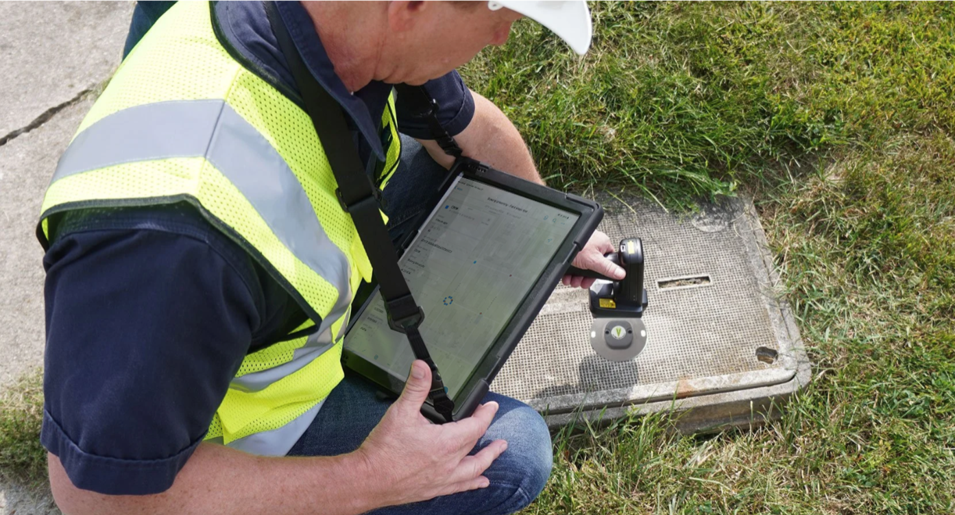
Reading an RFID tag in the field launches GIS data collection apps, verifying asset tag and asset history.
To capture a piece of that $3.7 trillion future, cities must move beyond "reactionary mode." A smart city requires a Verified Asset Backbone. You cannot run a predictive maintenance algorithm on a water main if your GIS (Geographic Information System) record is off by five feet.
This is where the physical and digital worlds must blend. By integrating RFID (Radio Frequency Identification) with GIS platforms like Esri ArcGIS, infrastructure is no longer "dumb" iron and concrete. It becomes "talkative."
"In a smart city, every asset—from a fire hydrant to a fiber optic junction—becomes a data point. Precision is the difference between a successful automated repair and a costly utility strike." — Urban Infrastructure Expert POV.
How InfraMarker Bridges the Gap

InfraMarker verifies asset identity on-site, directly in GIS.
At InfraMarker, we specialize in the "last inch" of the Smart City. While others focus on the cloud, we focus on the ground. Our solutions ensure that your infrastructure is truly ready to talk to the cloud:
RFID-to-GIS Mapping: We tag physical assets with high-durability sensors that link directly to your digital twin in real-time.
Millimeter Precision: Our integration with high-accuracy GNSS receivers means "down to the inch" isn't a marketing slogan—it's a technical standard.
Audit-Ready Resilience: By providing a physical-to-digital handshake, we help cities secure federal funding by proving a "State of Good Repair" with irrefutable data.
Is Your Infrastructure Cloud-Ready?
The transition to a Smart City doesn't happen overnight, but it does happen one asset at least. Don't let your municipality get left behind in the $3.7 trillion shift.
Ready to see the future of asset management? The team at InfraMarker are experts in blending RFID and GIS to create a seamless digital thread for your city. Contact our sales team for a live demo and discover how we can help your city start "talking" to the cloud today.
Sources & References:
Grand View Research:Smart Cities Market Size & Share Report, 2030
IBM/Harvard Business Review:The Real-World Cost of Poor Data Quality
InfraMarker:The Role of RFID in Smart City Infrastructure