Stephen H. Long - an officer, a surveyor and much more

Representation of the 1819 oil painting of Major Long. Portrait painted by Charles Willson Peale. Public domain.
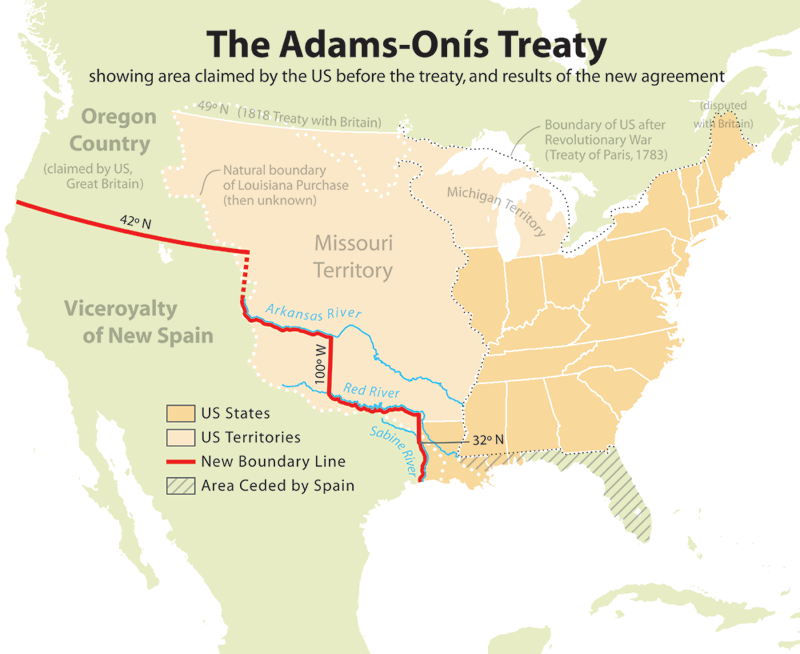
The Adams-Onis Treaty map. Creative Commons Attribution
Trappers, fur traders and riverman are known for exploring the West and opening it to settlement. Since the founding of the Army Corps of Engineers in 1802, the Corps has fielded a hard-working, highly trained cadre of surveyor-explorers who were instrumental in opening up the West to immigration.
Four of these intrepid surveyors are in the front rank of those who explored and mapped the Missouri River Basin and beyond: Major Stephen H. Long, Captain John Charles Fremont, Colonel Andrew A. Humphreys, and Lieutenant Gouverneur Kemble Warren.
Stephen Harriman Long
Long was a Dartmouth-educated surveyor-engineer who was experienced in river navigation. In 1817 he inspected the nation’s frontier defenses from the Arkansas river to Minneapolis using a six-oared skiff. This experience led him to recommend using steam powered vessels for future explorations. Fortunately, President Madison agreed, and commissioned Long to explore the Missouri River basin by steamboat.
John G. Calhoun, Secretary of War, gave the following orders to Major Long:
"You will assume the command of the expedition to explore the country between the Mississippi and the Rocky Mountains. You will first explore the Missouri and its principle branches and then in succession Red River, Arkansas and Mississippi above the mouth of the Missouri...The object of the expedition is to acquire as thorough and accurate knowledge as may be practicable of a portion of our country which is daily becoming more interesting but which is yet but imperfectly known. With this in view you will permit nothing worthy of notice to escape your attention...[1]

By Steamboat Western Engineer by Titian Ramsay Peale 1819 - Public Domain.
Long was the first military officer to include leading scientific experts of the day from the fields of botany, geology, zoology, and cartography in his expedition. They were a brilliant group drawn from leading educational institutions that included botanists, scientific illustrators, painters, geologists and engineers.[2] Long was also accompanied by a strong military force (due to local opposition and territorial counter-claims by the British and the Hudson Bay Company).
An arduous expedition
The expedition set out from St. Louis in May 1919 with three steamboats, including a specially built craft (designed by Long) that drew just 19 inches of water named The Western Engineer. The trip was incredibly arduous. The men literally had to dredge the river and cut timber along the way to feed the steam engines. It turned out that for two of the vessels, the trip was impossible. The only boat to make it to the Missouri River was the Western Engineer. By the time Long and his team reached his winter quarters at Engineer Cantonment on the Missouri River, the accompanying troops were suffering from scurvy and other diseases and couldn’t go on. Fortunately for Long, he had a legitimate reason to leave – he’d been called to return to Washington DC for further orders.
In DC, he learned that his orders were changed. He was to lead the expedition to the Rockies via the Platte River to the mountains and down the Red River border. Exploring that border was vital, since Spain had just ceded territory to the US, giving us access to the Pacific. Long and his 12 civilian volunteers plus a small military contingent started out toward the Front Range of the Rockies. The first sight of the mountains was a peak known as Les duex Oreilles (Two Ears), that was later renamed Longs Peak. The expedition returned via Arkansas and Canadian Rivers to Fort Smith. Long findings were published as Account of an Expedition from Pittsburgh to the Rocky Mountains ... Under the Command of Maj. S.H. Long.
The maps issued by Long and his crew are so detailed and accurate that some were still used throughout the Civil War. The maps and charts were also responsible for naming the area comprising the current state of Wisconsin.
Long eventually commanded five separate expeditions covering 25,000 miles with the resulting knowledge helped in the expansion of the upper American West.
Multi-talented designer
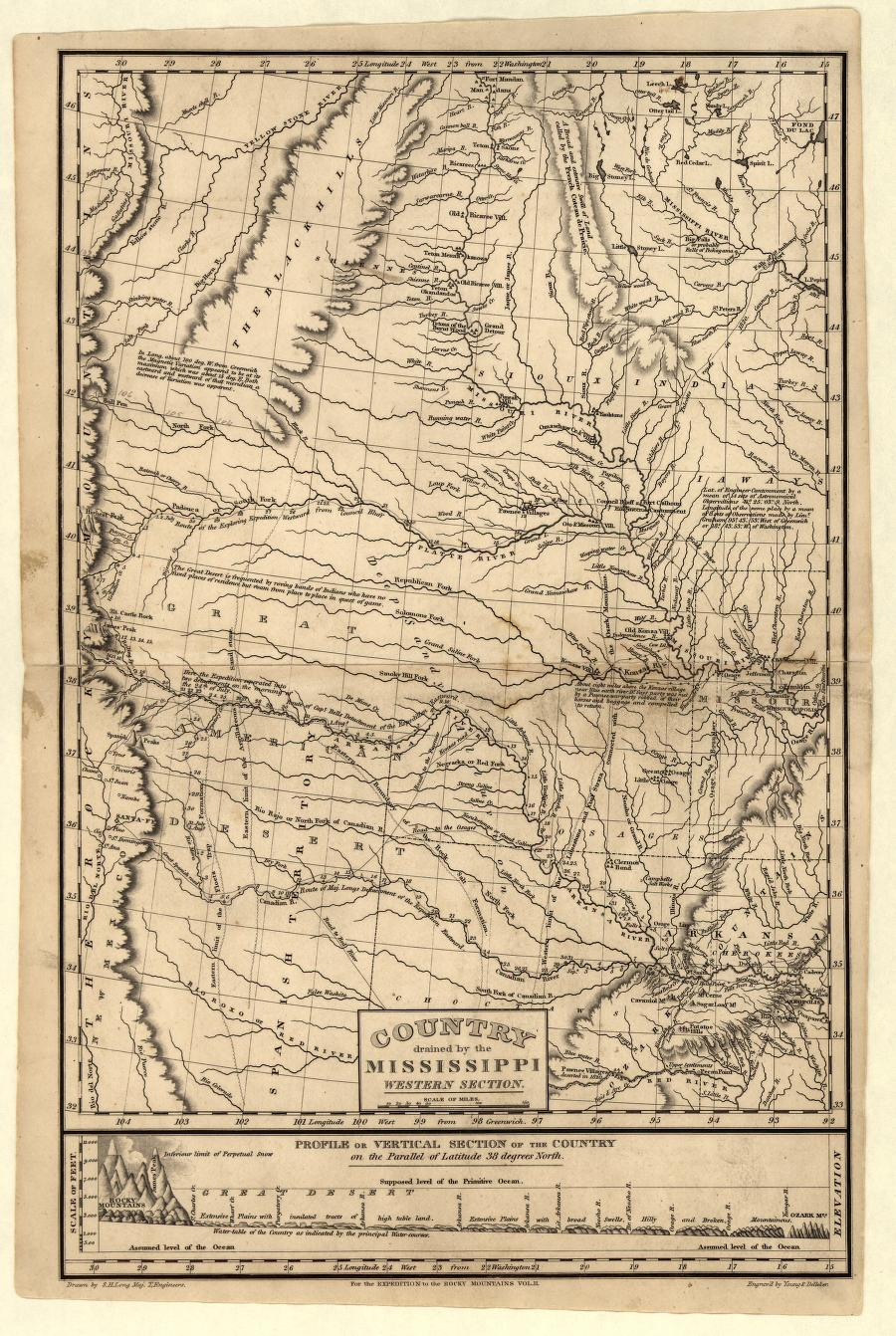
Long, S. H. & Young & Delleker. (1823) Country drained by the Mississippi. Retrieved from the Library of Congress.
Along with his exploration and map-making, Long also designed and patented railroad bridges, surveyed routes for the Western and Atlantic Railroads and designed more steamboats. His procedure of locating curves and a new kind of truss bridge advanced the science of laying rail and advanced the expansion of railroads throughout the country.
From the end of 1847 through early 1848 he was a member of the military panel for the Court Martial of John Charles Fremont.
In the early 1850's Long was superintendent of the Western Waters until the post was abolished in 1856. He then transferred to the lower Mississippi until two years before his retirement, in 1863 at the age of 78, and was promoted to colonel. Long retired to Alton, Illinois after 49 years of military service. He died September 4th, 1864.