From Brass to Bytes:
The Evolution of Infrastructure Marking
For more nearly 55 years, Berntsen International has been the silent guardian of the world’s boundaries. Since our founding in 1972, we have perfected the physical marker; moving from heavy, corrosive monuments to the lightweight, metallurgical-matched brass and aluminum markers that now define modern surveying.
But as we navigate 2026, the "State of Good Repair" requires more than just a physical point on the ground. It requires a digital thread. We’ve spent five decades perfecting the physical marker; now, we’ve perfected the digital one.
The Digital Transformation of the Surveying World
The surveying profession is currently undergoing a "digital revolution," where traditional paper maps and static PDFs are being replaced by decision-grade digital twins. According to recent industry reports, the global digital twin market is projected to skyrocket to over $380 billion by 2034, driven by a desperate need for predictive maintenance and accurate asset data.
However, a digital twin is only as valuable as the data feeding it. In the past, there was a massive "disconnect" between the office and the field.
The Problem: 65% of buried utility lines are privately owned or poorly documented, leading to over 500,000 utility strikes annually and damages exceeding $30 billion.
The Solution: Bridging the gap from Brass to Bytes.
InfraMarker®: Embedding Intelligence into Infrastructure
The InfraMarker RFID system is the culmination of Berntsen’s 50-year legacy. It allows you to embed data directly into the physical asset, ensuring that the "digital ghost" of your GIS record finally matches the physical reality in the field.
Scan the tag. See the history. Update the map. It’s that simple.
Authenticated Data: By using RFID (Radio Frequency Identification), you aren't just looking at a GPS coordinate that might drift. You are scanning a unique, unalterable digital ID physically attached to the asset.
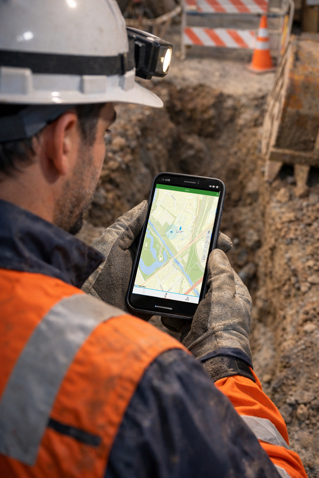
Seamless Integration: InfraMarker is built to play nice with the tools you already use. It connects directly with ArcGIS Field Maps and Survey123, allowing field crews to update GIS layers in real-time.
99% Accuracy: Organizations transitioning from manual tracking to RFID-enabled asset management report inventory and location accuracy rates of above 99%, effectively eliminating the "guesswork" that leads to dry holes and strikes.
"Our goal has always been to help surveyors and engineers do their work better. InfraMarker 'marries' standard RFID technology with the pinpoint magnetic relocation we've been known for since 1972." — Berntsen Leadership Perspective.
Why Berntsen? A Legacy of Trust
When you choose Berntsen, you aren't just buying a tag; you are partnering with a company that has been "Marking the Infrastructure of the World" for over half a century. From the summit of Mount McKinley to the depths of the Florida Keys, our markers are built to survive the harshest environments on Earth.
We’ve taken that same commitment to durability and applied it to our digital solutions. Our RFID tags are ruggedized, maintenance-free, and designed to last as long as the infrastructure they mark.
Discover the Future of Asset Management
Don't let your infrastructure remain in the "analog" past. Transition from brass to bytes and secure the future of your capital planning with the experts in surveying and mapping.
Ready to see a live demo? Our team is ready to show you how RFID and GIS can blend to create a seamless, audit-ready record of truth for your organization.
Sources:
Berntsen International: 50 Years and Still Innovating History
Fortune Business Insights: Digital Twin Market Size & Growth Report 2026-2034
Market Growth Reports: Underground Utility Mapping Market Trends [2035]
Common Ground Alliance (CGA): Annual DIRT Report on Utility Damage Costs
Technowave Group: Top RFID Asset Management Solutions for 2026
Hashtags: #InfraMarker #RFID #AssetTracking #DigitalTwin #Berntsen #Surveying #GIS #PublicWorks