Design Starts in the Dirt:
Why Smart Cities Fail Without Deep Geodetic Control
A Digital Twin is only as stable as the physical rod that anchors it to the earth.
Executive Summary for Planners & Principals:
The Reality: Major urban infrastructure projects often have a 5-10 year gap between initial survey and final construction.
The Risk: Surface-level control points shift due to frost heave, traffic vibration, and soil settling, causing "Coordinate Drift."
The Solution: Deep-driven Top Security Rods anchor the coordinate system to stable strata, ensuring the Digital Twin matches the physical site years later.
The "Floating" City Problem
We live in the era of the Smart City. Architects design in Revit, Urban Planners simulate traffic flows in ArcGIS, and Engineers build Digital Twins that model every pipe and wire.

Anatomy of a frost heave during spring thaw. The side of a 6-inch (15-cm) heave with the soil removed to reveal (bottom to top):
1. Needle ice, which has extruded up from the freezing front through porous soil from a water table below 2. Coalesced ice-rich soil, which has been subject to freeze-thaw 3. Thawed soil on top.
But these multi-million dollar models suffer from a critical vulnerability: They assume the ground stands still.
It doesn't.
In the 3 to 5 years it takes to move a project from "Feasibility Study" to "Shovel Ready," surface soil moves. Frost heaves the ground up. Heavy traffic vibrates it down.
The Consequence: If your geodetic control network relies on shallow rebar or surface nails, your "Smart City" model is floating on a shifting sea.
The Cost: When construction finally begins, the steel beams don't line up with the footings because the control points have drifted 3 inches. The "Change Order" clock starts ticking.
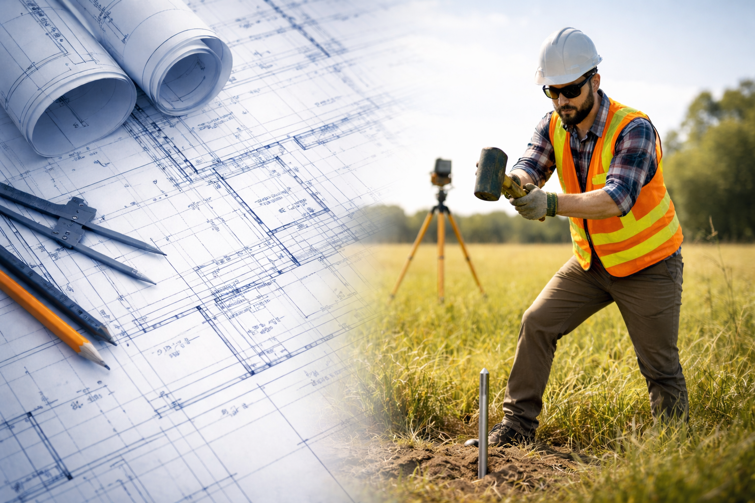
Berntsen’s exclusive drive-in monuments that resist shifting
The 3D Rod for the 3D World
You cannot build a 21st-century city on 20th-century surface markers. You need 3D Stability.
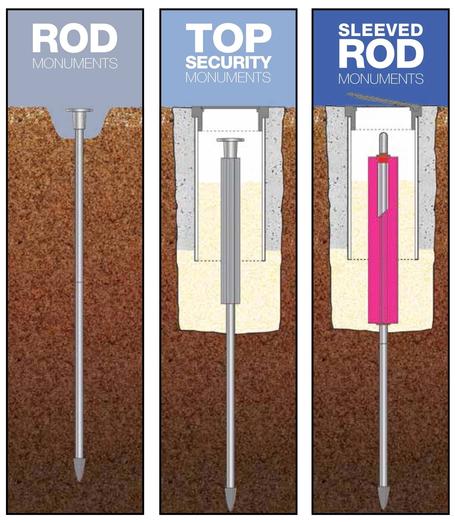
This is the engineering philosophy behind Top Security Rods. Unlike a standard stake, a Top Security Rod system is designed to bypass the unstable surface layer entirely.
Driven to Refusal: The rods are driven deep into the earth (often 20, 30, or 50 feet) until they hit a refuse layer or bedrock.
Sleeved Isolation: A PVC sleeve isolates the upper portion of the rod from the soil. When the ground freezes and expands, the soil moves around the rod, but the rod itself remains dead still.
The Result: A coordinate captured in 2025 will be identical to the coordinate checked in 2030.
Asset Certainty for the C-Suite
For the Principal of an Architecture firm or the Director of City Planning, this is a question of Data Governance.
You invest heavily in LiDAR scans, drone photogrammetry, and BIM Management. If you do not invest in the geodetic control network that ties those datasets together, you are building a skyscraper on a foundation of sand.
Cheap Markers: Save $500 today. Risk $50,000 in rework later.
Deep Rods: Invest in the foundation. Secure the data for the lifecycle of the project.
Conclusion
Great design doesn't start with a mouse click. It starts in the dirt.
Before you render the glass facade or simulate the autonomous vehicle routes, ensure your map is anchored to the planet. Use Top Security Rods to bridge the gap between the digital vision and the physical reality. See Berntsen’s Top Security Monuments here.