
How New Applications of GIS Are Changing the Way We Manage Our World
November 18 is GIS Day – a celebration of Geographic Information Systems and the innovative ways organizations are using location-based data to solve real-world problems.
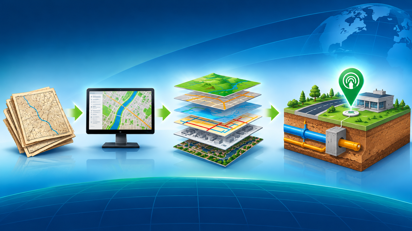
GIS has come a long way from its origins as a tool for creating maps and analyzing geographic information. Today, it is becoming an essential part of how organizations operate, maintain infrastructure, protect natural resources, respond to emergencies, and make better decisions.
Over the past year, advances in artificial intelligence (AI), real-time data collection, digital twins, and connected technologies have expanded what GIS can accomplish. More importantly, these technologies are moving beyond experimental projects and finding practical applications in everyday operations.
Here are five developments demonstrating how GIS is changing the way we work.
1. AI and GIS are making infrastructure management smarter
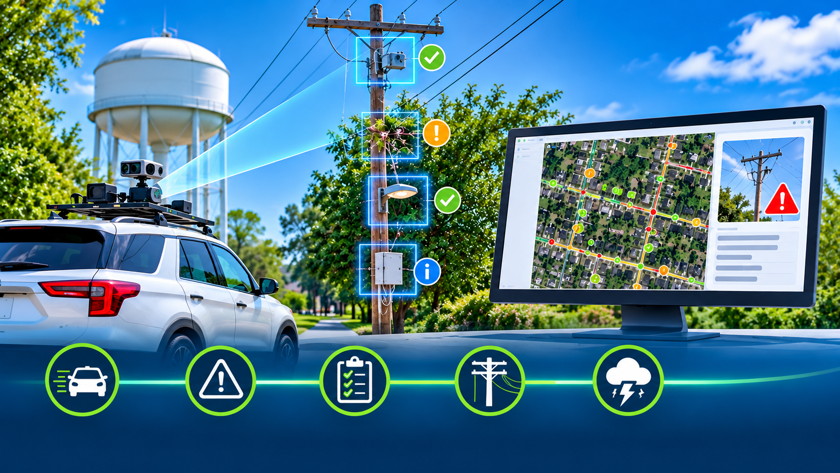
One of the most significant developments in GIS is the integration of artificial intelligence into infrastructure inspection and asset management.
Consider the City of Starke, Florida. In 2026, the small municipal utility partnered with technology providers to replace decades-old paper maps and institutional knowledge with a modern GIS-based utility management system.
Using vehicle-mounted cameras and AI-powered analysis, the project collected information on more than 2,300 utility poles in less than seven hours of driving time. AI helped identify structural defects, vegetation encroachment, lighting conditions, and third-party attachments.
The information was integrated directly into ArcGIS, giving utility personnel a searchable, centralized inventory of their infrastructure.
The project demonstrated how AI and GIS can work together to:
Automate infrastructure inspections.
Identify potential maintenance problems.
Prioritize repairs based on asset condition.
Improve visibility into infrastructure ownership and attachments.
Support better maintenance and storm-response planning.
For utilities and public works departments, this means less time collecting information and more time acting on it.
2. Digital twins are bringing environmental systems to life
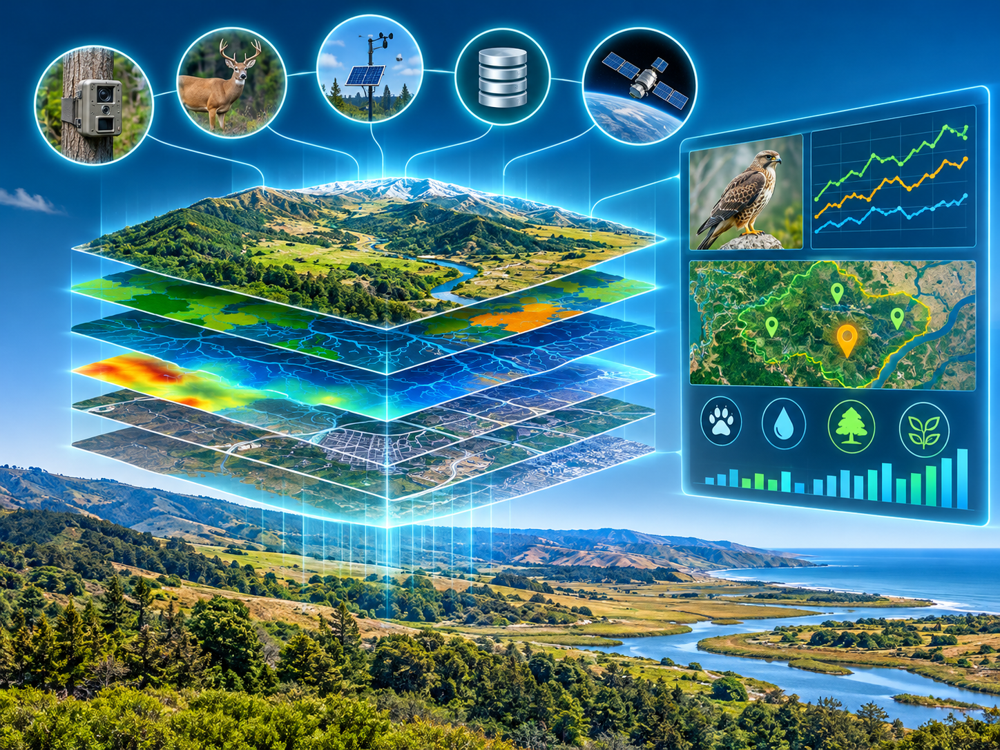
Digital twins are virtual representations of physical assets, places, or systems. When combined with GIS, they allow organizations to visualize conditions, monitor changes, and test potential solutions before implementing them in the real world.
In 2026, The Nature Conservancy, the University of California, Santa Barbara, and Esri advanced an innovative example at California's Jack and Laura Dangermond Preserve.
Their Research and Discovery Digital Twin brings together nearly 1,000 GIS data layers covering everything from wildlife and vegetation to hydrology, soils, roads, and infrastructure.
The platform connects more than 120 research projects involving 50 partner institutions.
Researchers can use this information to study ecosystems, understand environmental changes, and evaluate conservation strategies. Data from wildlife cameras, IoT sensors, and scientific databases can also be incorporated into the digital environment.
This approach opens new possibilities for:
Monitoring wildlife populations and habitats.
Understanding watershed conditions.
Evaluating the effects of land-use changes.
Testing species recovery strategies.
Planning conservation investments.
GIS is no longer simply showing us where environmental resources are located. It is helping us understand how entire ecosystems function and change over time.
3. GIS is becoming an important tool for public health and emergency preparedness
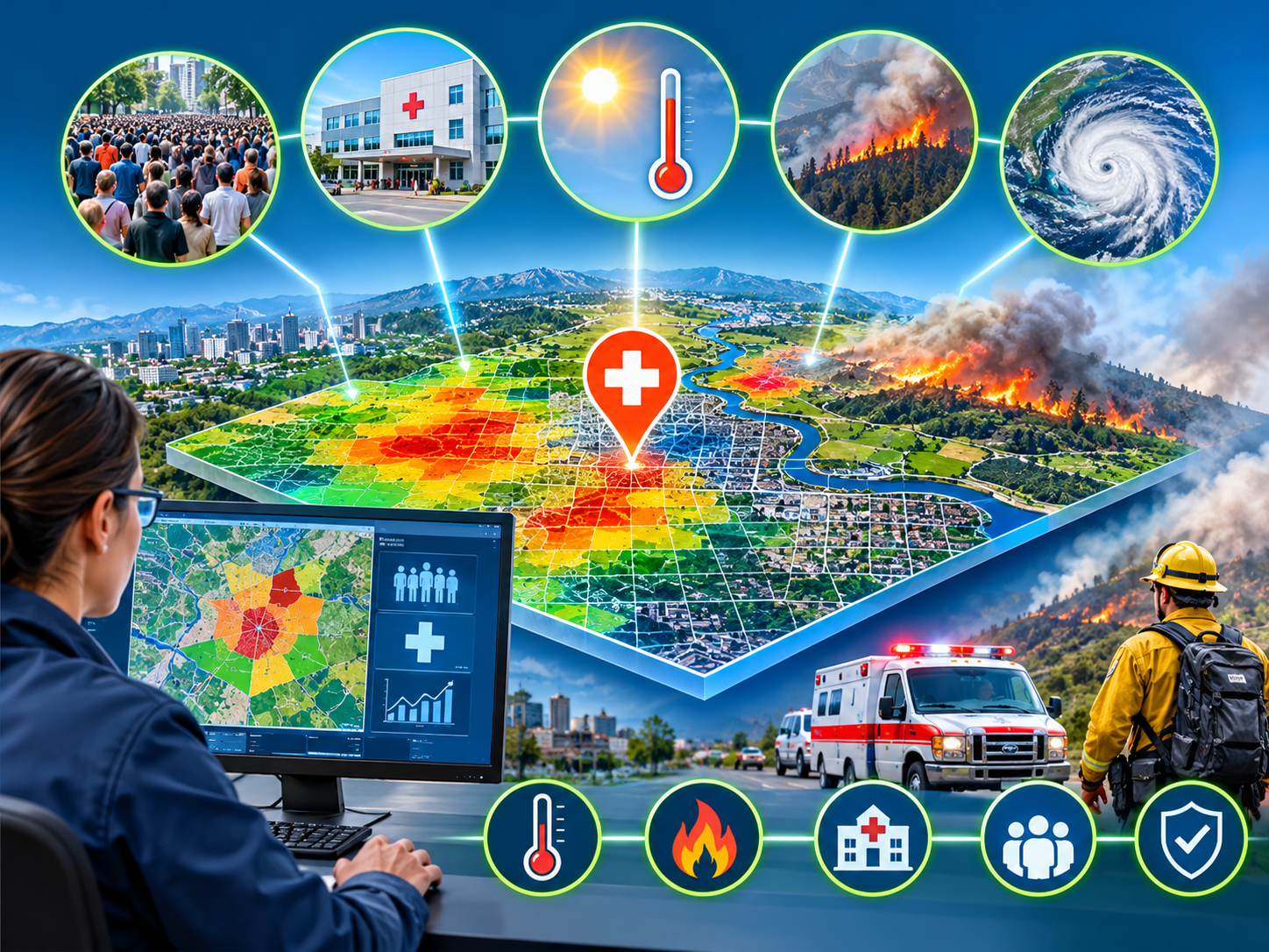
GIS is increasingly being used to connect environmental conditions, population data, and public health information.
In August 2026, the World Health Organization's European Region introduced a roadmap to strengthen GIS applications in public health through 2030.
The initiative recognizes the importance of location-based information in identifying health risks, planning services, and responding to emergencies.
For example, GIS can combine information about population density, healthcare facilities, environmental conditions, heat exposure, and wildfire activity. This allows public health professionals to identify vulnerable communities and determine where resources are needed most.
The applications include:
Mapping areas affected by extreme heat.
Tracking wildfire exposure and associated health risks.
Identifying communities with limited access to healthcare.
Supporting emergency response and resource allocation.
Improving disease surveillance and preparedness.
By bringing multiple sources of information together, GIS helps decision-makers see the bigger picture and respond more effectively.
4. GIS is revealing connections between infrastructure assets
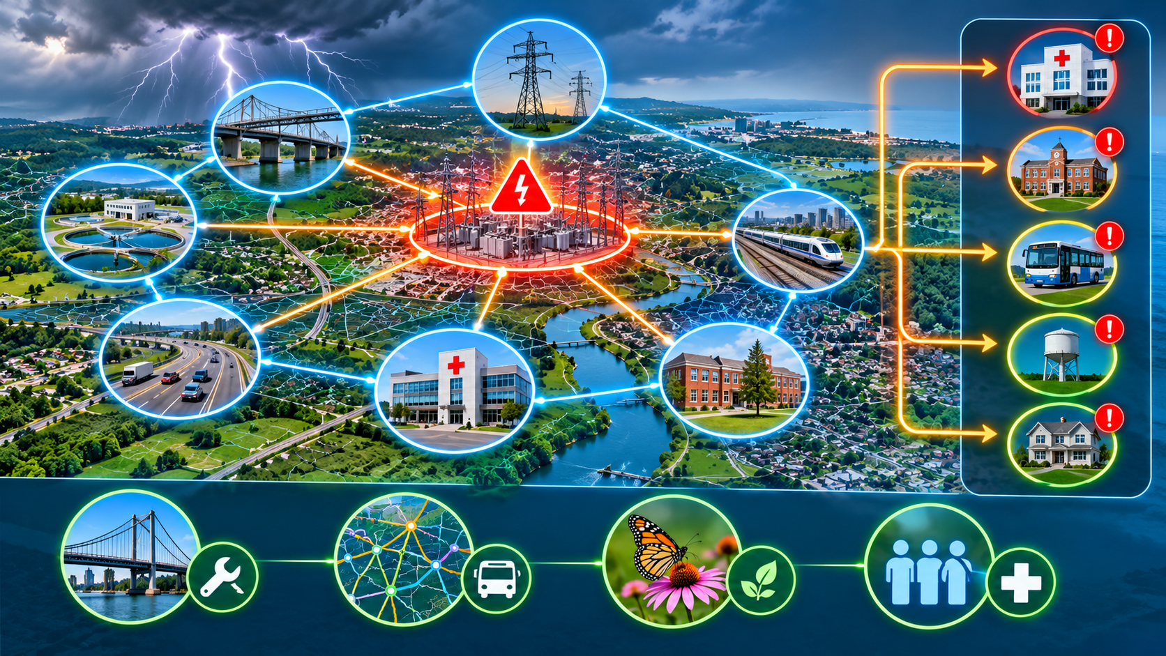
Traditional GIS maps show where assets are located. Newer GIS applications are going further by revealing how those assets are connected and how problems in one location can affect other systems.
At the 2026 Esri User Conference, knowledge graphs and spatial analytics demonstrated how organizations can examine relationships between infrastructure networks.
For example, when extreme weather damages a power grid, the consequences may extend far beyond the damaged equipment. Hospitals, schools, transportation systems, water facilities, and other critical services may also be affected.
By connecting infrastructure records and analyzing their dependencies, GIS can help organizations understand these cascading impacts.
Other applications demonstrated in 2026 included:
Prioritizing bridge repairs using commuter and transportation data.
Identifying relationships between transportation networks.
Understanding how changes to one ecosystem can affect other species.
Improving healthcare access through spatial analysis.
This represents an important shift: GIS is becoming a tool for understanding not just individual assets, but the relationships and dependencies that connect entire systems.
5. RFID and GIS are making field data more accurate and actionable
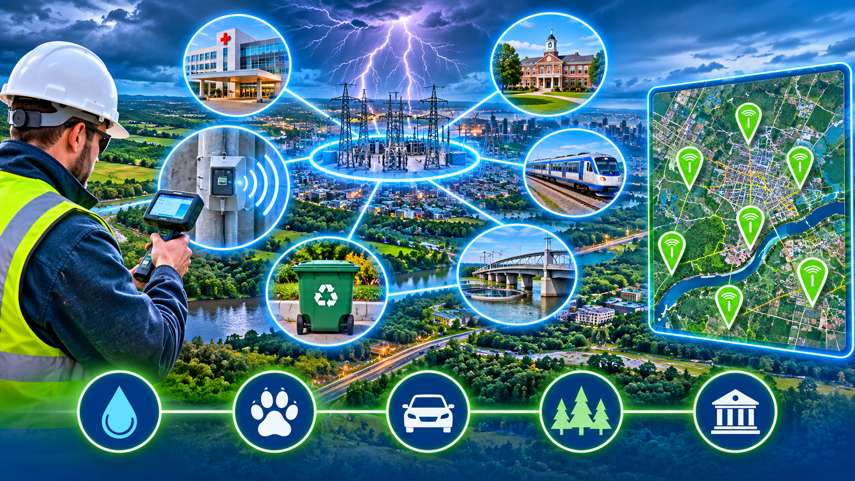
Another important development is the growing connection between GIS and technologies that automatically identify physical assets in the field.
GIS provides the geographic framework for organizing information. RFID adds a reliable way to identify and retrieve information about the physical asset itself.
Together, these technologies help close the gap between digital records and the real-world infrastructure they represent.
For example, an RFID-tagged utility asset can be scanned by a field technician. Its unique identification number can connect directly to its GIS record, bringing up its location, inspection history, maintenance information, and other relevant details.
This approach has applications across many industries:
Water and wastewater: Identify buried valves, hydrants, manholes, and other infrastructure without relying solely on outdated maps or institutional knowledge.
Wildlife research: Connect fish and wildlife PIT tag identification with observation locations and GIS records.
Waste management: Verify collection of RFID-tagged recycling and waste receptacles while recording pickup locations and times.
Transportation: Track infrastructure components, inspection records, and maintenance activities.
Public administration: Improve the tracking and chain of custody of important equipment and election materials.
With solutions such as Berntsen's InfraMarker® RFID platform, organizations can connect physical asset identification with Esri ArcGIS, creating a more complete picture of what they own, where it is located, and what is happening in the field.
The result is better data, fewer manual entry errors, and more reliable information for operational decisions.
GIS Day 2026: The future is about connecting information to action

The developments of the past year demonstrate that GIS is much more than a mapping technology.
AI is helping organizations collect and analyze information faster. Digital twins are making it possible to model complex environments. Spatial analytics are revealing relationships between interconnected systems. And RFID is helping organizations connect digital records with the physical assets they manage.
But one thing remains essential to all these advances: accurate, reliable data.
Even the most sophisticated GIS platform depends on knowing what an asset is, where it is located, and whether the information associated with it is current.
That is where accurate asset identification and field data collection become critical.
This GIS Day, we celebrate the people and technologies making better use of location-based information. As GIS continues to evolve, connecting physical assets with accurate digital records will play an increasingly important role in building smarter, safer, and more resilient communities.
Happy GIS Day from Berntsen International and InfraMarker!
The examples in the blog are based on these 2026 developments:
City of Starke: A Small Utility Sees Big Gains with GIS and AI – AI-powered utility inspections and asset inventory.
A Digital Twin of Nature to Test Ideas for the Future – The Nature Conservancy's Dangermond Preserve.
WHO: GIS Roadmap for Public Health – August 2026.
Esri: Real-World Stories That Show What's Possible with Knowledge Graphs – August 2026.
Deloitte: How Utilities Are Integrating AI and Geospatial Intelligence – July 2026.