Captain Cook, Surveyor
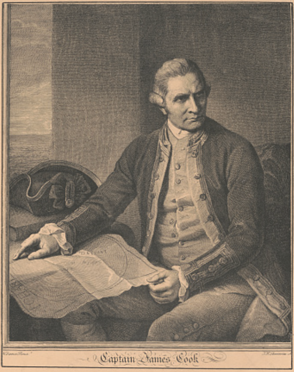
Captain James Cook, 1923. [United States: publisher not transcribed] Retrieved from the Library of Congress.
Surveying has always been essential to explorers, such as Daniel Boone, Lewis & Clark and George Everest. Captain Cook, who was the first European to locate Hawaii, New Zealand, and Australia was a surveyor.
James Cook was born in the Yorkshire town of East Marton in 1728. Although his father was a farm laborer who hadn’t traveled far from his native Scotland, James’s life took a radically different path. When Cook was eight years old, he attended a local charity school where he got a good foundation in mathematics. By the time he was 17, Cook was on his own and began an apprenticeship at a shipping company transporting coal by sea between Newcastle and London in a four-week round trip.
A seafaring life
His apprenticeship came to an end in 1749, but Cook stayed on, working hard to build his navigational skills and advance in his understanding of mathematics and astronomy. In 1775, he was offered the opportunity to become Master (First Mate) on the ship Friendship, but he declined and instead joined the Royal Navy. This choice seemed inexplicable, because his move to the Royal Navy meant he essentially had to start over. Undaunted, he soon found himself patrolling the English Channel during a war with France. He proved capable under fire and was promoted to Full Master (Captain).

Cook, James, active 1762-1775. "A draught of the harbour of Hallifax and the adjacent coast in Nova Scotia." Map. London: James Cook, 1766. Norman B. Leventhal Map & Education Center.
His first ship as Master was the HMS Pembroke and his first voyage was as part of a fleet determined to drive the French from modern-day Canada in 1757. It was on this first voyage that Cook experienced the horror of scurvy, with most of his crew ill and 23 dead [1]. For much of the time in Halifax, his ship was unable to operate due to this illness. Nevertheless, while in Halifax (Canada), Cook was taught land surveying skills by an officer on his ship and used these skills to create charts of Halifax town and its harbor. His ship was also tasked with sounding and buoying the very dangerous channels of the St. Lawrence River. This work ensured the safe passage of the British fleet in waters where the enemy had not dared to risk their vessels [2].

Painting by Samuel Atkins (1787-1808) of Endeavour off the coast of New Holland during Cook's voyage of discovery 1768-1771.
His skill in surveying land and sea was quickly recognized by Admiral Saunders, who arranged to have him appointed as Master of the H.M.S. Northumberland. Cook spent the winter studying the theoretical side of surveying and attained considerable knowledge of the subject. In the Spring of the following year, the Northumberland operated in the St Lawrence, and Cook continued surveying the Quebec Basin.
After fights between the British and French over cod fishing bases on the Newfoundland coast in 1762, the Governor of Newfoundland realized the importance of having accurate maps of the area. He commissioned Cook and other surveyors to create them. Cook was employed for five summers there, spending his winters in Britain, before returning to London in 1767 [3].
In 1768, Cook’s reputation as a competent captain and excellent surveyor resulted in his appointment as Master of the HMS Endeavour, a ship designed for exploration, financed by the Royal Society. He was directed to “explore ‘as great an extent of it as you can, carefully observing the true situation thereof both in latitude and longitude, the variation of the needle, bearings of headlands, height, direction and course of the tides and currents, depths and soundings of the sea, shoals, rocks etc., and also surveying and making charts and taking views of such bays, harbours and different parts of the coast, and making such notations thereon as may be useful either to navigation or commerce.’”[1] His ship was equipped for surveying, with quadrants, sextants and compasses, a theodolite, Gunter’s chain and a plane table.
Cook was extraordinarily successful – so much so that he led three voyages of exploration.
The First Voyage
View of the Endeavour's watering place in the Bay of Good Success, Tierra del Fuego, with natives. Alexander Buchan, January 1769.
Life at sea, especially before there were accurate maps, was very hazardous. Strict discipline was enforced, and sailors lived in cramped conditions, did hazardous work and the food was often rotten and contaminated by vermin. Above all, they faced the daily dangers of sea and weather. Then there was tuberculosis and scurvy, which was a specific risk on long voyages. Scurvy is caused by the lack of vitamins C and B that are found in citrus fruits and many vegetables. Scurvy was often fatal and it was a horrible way to die. Symptoms included blackening of the skin, ulcers, breathing difficulty, stiffened limbs, hallucinations and rotting gums leading to tooth loss.
Cook’s ship was chosen to test a hypothesis that vegetables, malt and fruit could prevent scurvy. The Endeavour was supplied with bushels of malt, 1000 pounds of portable soup, vinegar, mustard wheat, and 'proper Quantities of sauerkraut and Rob’ (fruit juice) [4].
Cook was on a tight timeframe to conduct his explorations and report back to the Royal Society. His first voyage was to the Pacific Ocean to record the eclipse of the sun by Venus (and secretly, to search for a place called Terra Australis). The expedition sailed from England, rounded Cape Horn and continued to Tahiti, where the observations were made of the eclipse.
During his surveys, Cook rarely went ashore to fix positions by regular triangulation. That meant the framework of his surveys was based on the astronomically determined positions of the ship and of coastal features. The scale of his charts had to be derived from the computed distances between fixes, to which the ship's dead reckoning, from compass and log, was adjusted. He was frustrated by his inability to do proper surveys and noted on one survey that “The word survey is not to be understood here in its literal sense".
Cook mapped the entire New Zealand coastline, then sailed westward where his crew became the first Europeans to encounter the east coast of Australia. Continuing northward, Cook claimed the entire Australian coastline for Britian. Cook returned to England via Indonesia and the Cape of Good Hope [5]. During the voyage, Cook had just five cases of scurvy and no deaths. He wrongly attributed it to the malt he forced everyone to drink. In reality, malt has little preventive effect, but the other provisions and a strict regimen of cleanliness contributed to his success. To this day, Cook is acknowledged as “the conqueror of the sea's great plague”.
Second Voyage

A Map from the Second Voyage: Dusky Sound at the Southern Tip of New Zealand,” Gallery
The Royal Society directed Cook to find Terra Australis on the second voyage. They believed it to lie further south than Cook had previously gone. In 1772, Cook sailed so far south that he nearly reached Antarctica, but had to return to Tahiti to re-supply and try again. This time he found Easter Island, the Marquesas Island and the Friendly Isles. Before he headed back to England, Cook made one last sweep across the South Atlantic. There he located and charted Clerke Rocks and the South Sandwich Islands. The charts made during this voyage with a new marine chronometer were so accurate they were still being used well into the 20th century. His return to Britain in 1775 with his findings was enough to dispel any remaining belief in Terra Australis.
Third Voyage

Death of Captain Cook, as eye witnessed by James, the brother of John Cleveley the Younger
On 2 February 1778, Cook sailed along the coast of North America and Alaska, mapping and searching for a Northwest Passage to the Atlantic Ocean for approximately nine months. He returned to Hawaii to resupply, exploring the coasts of Maui and the Big Island of Hawaii and trading with locals, then making anchor in Kealakekua Bay in January 1779. Cook and his crew were initially welcomed and treated with honor but soon made the inhabitants angry by removing the wood used to border the natives' sacred "Morai" burial ground, used for high-ranking individuals and depictions of their gods.
Cook then attempted another Northern Pacific exploration, but a broken foremast meant they had to return Hawaii, and this time they were not welcomed. The Hawaiians were fed up with the Englishmen and tried to antagonize them, including stealing a long boat.
Cook attempted to ransom the Hawaiian King and restore order but was struck down by the villagers and stabbed to death, along with four other crewmen.
The remaining crew members returned to Britain in October 1780 where the King completed Cook’s account of the voyage [6].
The new country

Flag of Hawaii flying over Haleakalā National Park on Maui, Hawaiʻi
By the time Cook died, a new country had been created. The United States would eventually include the Hawaiian Islands as the 50th state on August 21, 1959. Today, the Hawaiian flag reflects its history by including the Union Jack as part of the design.
Surveying was key to Cook’s ascendance in the Royal Navy and played a major role in extending Britain’s imperial aspirations. Today, surveying remains central to stable economic development, and Berntsen works right along side surveyors to provide high-quality products that make their lives easier.
References:
[1] https://www.historicaldance.au/dancing-for-sailors/
[2] Captain Cook as a Hydrographer | Captain Cook Society
[3] Captain Cook family history and his early life | Visit Whitby
[4] BBC - History - British History in depth: Captain Cook and the Scourge of Scurvy
[5] Voyages · Captain Cook's Voyages of Discovery · Gallery (umn.edu)
[6]Death of James Cook - Wikipedia
Sources:
https://gallery.lib.umn.edu/exhibits/show/captaincook/mapmaking
https://www.captaincooksociety.com/cooks-life/captain-cook-personally/captain-cook-as-a-hydrographer
https://www.rmg.co.uk/stories/topics/early-life-career-james-cook
https://www.visitwhitby.com/blog/captain-cook-family-early-life/