
News and Events
Archive
- May 2025
- April 2025
- March 2025
- February 2025
- January 2025
- December 2024
- November 2024
- September 2024
- August 2024
- July 2024
- June 2024
- May 2024
- April 2024
- March 2024
- February 2024
- January 2024
- December 2023
- November 2023
- October 2023
- September 2023
- August 2023
- July 2023
- June 2023
- May 2023
- April 2023
- March 2023
- February 2023
- January 2023
- December 2022
- October 2022
- August 2022
- July 2022
- June 2022
- May 2022
- April 2022
- March 2022
- February 2022
- January 2022
- December 2021
- November 2021
- October 2021
- September 2021
- August 2021
- July 2021
- June 2021
- May 2021
- April 2021
- March 2021
- February 2021
- January 2021
- December 2020
- November 2020
- October 2020
- September 2020
- August 2020
- July 2020
- June 2020
- May 2020
- April 2020
- March 2020
- February 2020
- January 2020
- December 2019
- November 2019
- October 2018

Smarter Aquaculture Management with RFID
Managing and protecting fish populations is more critical than ever. Aquaculture now supplies nearly half of the world’s farmed and wild fish and the demand continues to surge.

Celebrating Earth Day —
Technology, Stewardship, and a Sustainable Future
Each year on April 22, the world comes together to celebrate Earth Day—a reminder of our shared responsibility to protect the natural world. At InfraMarker and Berntsen International, our connection to the earth has been lived for more than 50 years, starting with innovative, lightweight marking products that helped outline the boundaries of our national parks.

Look-Alike Assets, Real Problems:
How InfraMarker Simplifies Identification and Accelerates Field Asset Management
In the electric utility sector, precision is essential. Yet in the field, teams frequently encounter a challenging and potentially risky scenario: many infrastructure components appear nearly identical.

RFID- The silent technology enhancing our lives every day
Radio Frequency Identification (RFID) technology uses radio waves to identify virtually anything. It is a wireless system consisting of an RFID tag and an RFID reader. RFID tags store data that can be read, even from a distance—without making any physical contact or requiring a line of sight.

Disaster response and resilience
A recent survey revealed that many people believe that natural disasters are more frequent and severe than in the past. It turns out that this observation is backed up by facts. According to the National Oceanic and Atmospheric Administration (NOAA), the frequency of natural disasters is increasing year-over-year. There were 28 weather and climate disasters in 2023, surpassing the previous record of 22 in 2020, tallying a price tag of at least $92.9 billion.

It’s 811 Day
This 8/11 is a beautiful Sunday and many homeowners will be using the day to tackle some home improvement projects, such as building a deck, installing a new mailbox or installing a fence. In fact, 74% of homeowners have or will dig on their property on their property this summer. Unfortunately, nearly 40% of these won’t call 811 ahead of time to mark buried utilities.[1]

RFID Improves Data Center Operations
More than 90% of organizations use cloud computing to run enterprise applications[1]. That means that everything from hospitals and first responders to Fortune 500 companies and governments rely on the cloud. Soon, air traffic control and police departments will be cloud-based as well. Society won’t be able to function without the cloud.

AEC Firms embrace RFID
AEC is the acronym for Architecture, Engineering and Construction, which is a collection of services engaged in the planning and execution of all types of construction projects. It’s essentially the term for a deep and intricate collaboration between partners in order to bring any project to fruition.
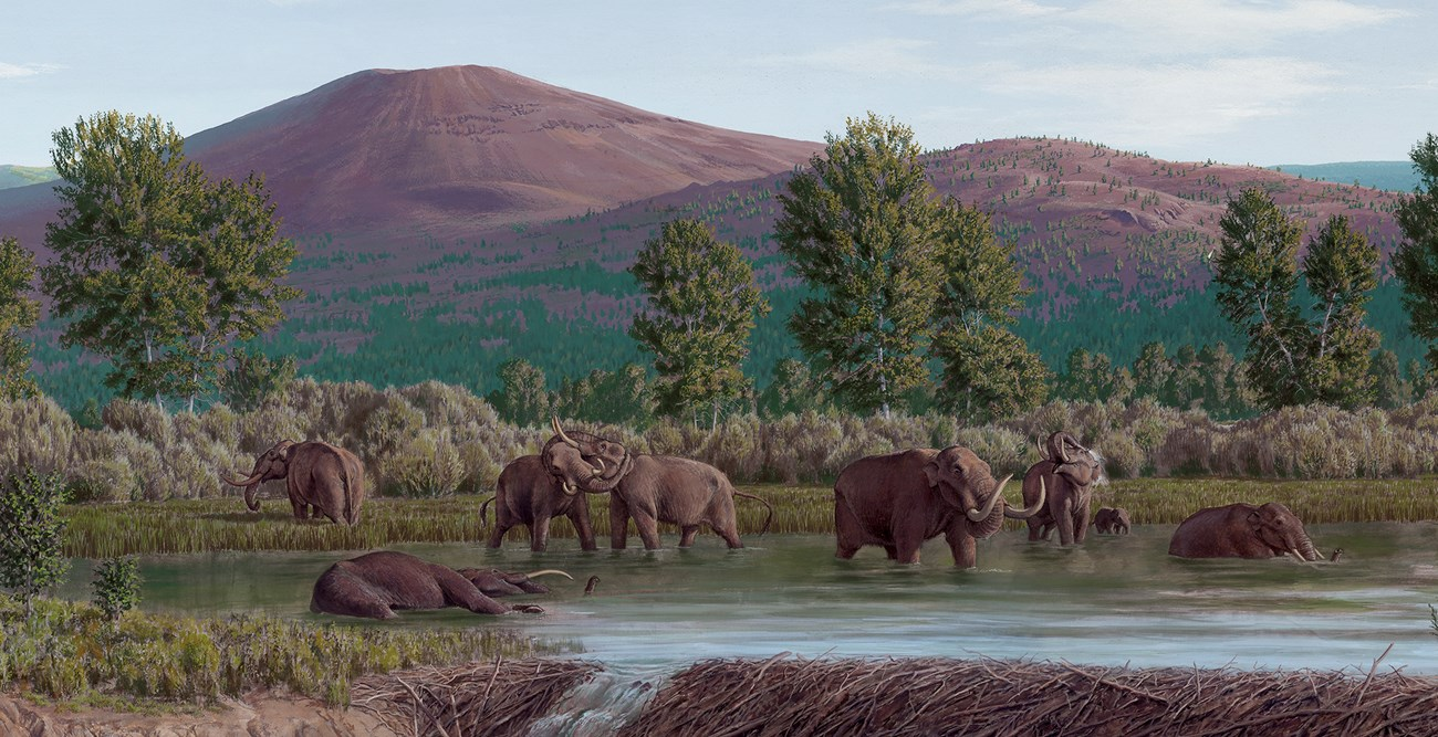
Owning fossil history with oral tradition and science
Before paleontologists began scouring indigenous lands for proof of evolution in the fossil record, Native Americans had long since incorporated these “new discoveries” into their cultures. Centuries before Europeans arrived, native inhabitants of the Americas understood that the land had once been teeming with massive creatures that ruled the earth, water and sky.

It’s National Public Works Week
If you’ve taken a trip recently, you’ve probably noticed the construction – on roads, bridges, dams, airports, railways and other large projects – causing frustrating backups and bottlenecks. Unfortunately, this inconvenience is one of the costs for years of infrastructure neglect.

RFID in Revolutionizing Asset Tracking Across Industries
A recent article highlighting the 25 Technologies that have changed the world lists the usual blockbuster inventions, such as the Apple iPhone, Wi-Fi, AI, facial recognition, drones, DNA testing, social platforms, quantum computing and bitcoin. However, not all of these world-changing technologies are so famous. Who knew that Radio Frequency Identification (RFID) is a world-changing technology?

Tree surveys - more important than ever
Before the arrival of European immigrants in the United States, forests totaled about 1.05 billion acres, or about 43 percent of the country. Clearing of forest land in the East between 1850 and 1900 averaged 13 square miles every day for 50 years.

RFID - resilient and adaptable
Radio Frequency Identification (RFID) has been around for a long time. The precursor technology to RFID was originally developed as a musical instrument by the Russian physicist Leon Theremin, patented in 1928. The Theremin produces music by manipulation of electromagnetic fields around two antennae to produce sound.
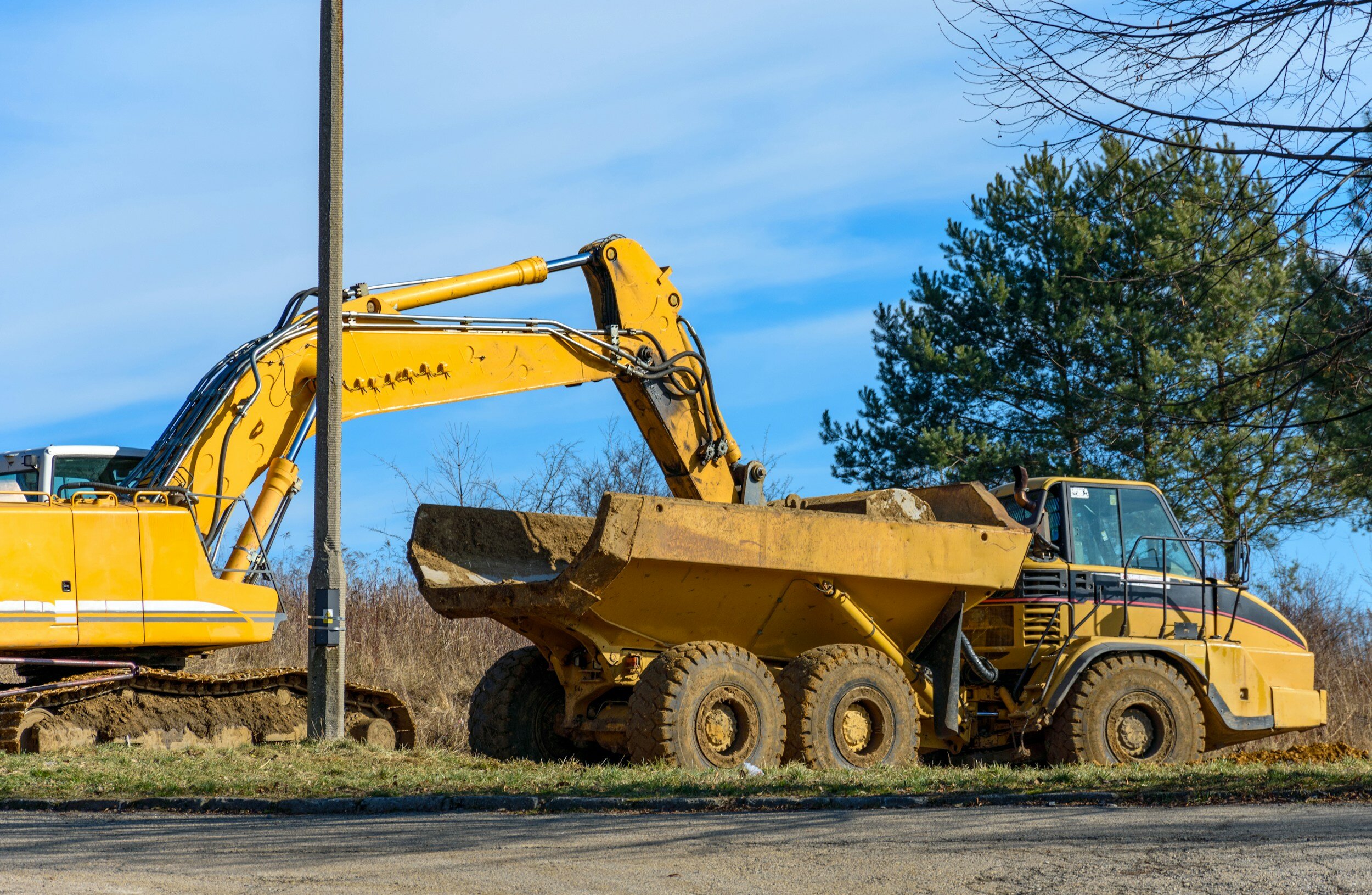
Damage prevention saves lives and money
April is recognized by Congress and most Governors across the U.S. as National Safe Digging Month as shovels (and backhoes) hit the ground for a busy season. It’s well known that excavation is a dangerous business. Excavation strikes on public utility lines lead to more than 2,000 injuries and 400 deaths each year[1]. The Common Ground Alliance (CGA) states that accidental utility strikes cost the U.S. at least $30 billion annually, based on self-reported data by stakeholders and state 811 call centers. And it looks like things are getting worse, not better.

Federal Agencies Get the Job Done
For more than 50 years, Berntsen has worked alongside federal agencies to provide useful and quality products. From monuments that can be set in wetlands to RFID markers that integrate with Geographic Information Systems (GIS), federal agencies rely on Berntsen to deliver quality products that help them fulfill their missions.

Key Trends in 2024
The “Fourth Industrial Revolution” is well underway. Back in 2011, economist Klaus Schwab coined the term to refer to the rapid digitization and accessibility of technologies that spark a global shift in processes – in everything from how we communicate to how businesses and governments are managed.
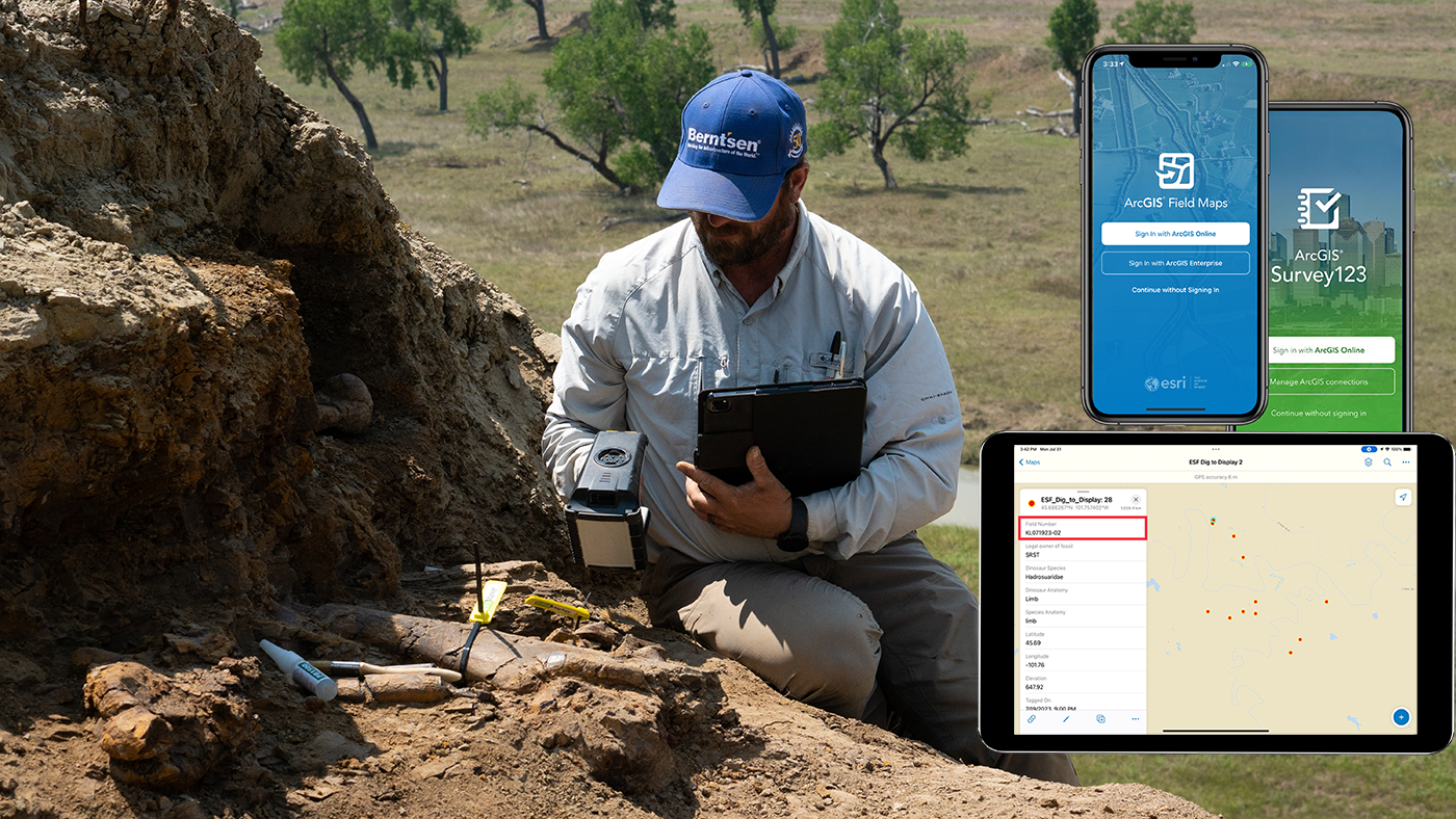
GIS Day - Mapping our past with the help of RFID
It’s Geographic Information Systems (GIS) Day! Since 1999 when it was first celebrated as the grand finale to Geography Week, GIS has been quickly put to use by many professions, industries and researchers. Today, GIS is becoming indispensable for paleontology - with the help of RFID.

Berntsen Adds NFC capability to the InfraMarker RFID App
Berntsen International, a leading manufacturer of infrastructure marking products, announces that its InfraMarker RFID App now supports Near Field Communication (NFC) and is available on both the Apple App Store and Google Play.

InfraMarker Brings RFID Power to Esri Field Operation Applications
Berntsen International, a leading manufacturer of infrastructure marking products, announces that its InfraMarker RFID app is now fully integrated with Esri’s ArcGIS Survey123 and ArcGIS Field Maps mobile applications.

RFID + GIS = SUE Enhancement
Subsurface Utility Engineering (SUE) that leverages Geographic Information Systems (GIS) and Radio Frequency Identification (RFID) deliver substantial benefits in the management and protection of underground assets.