Operation Overlord
Blog by Emily Pierce, PLS, CFedS
Seventy-eight years ago today, Operation Overlord was launched – known as D-day, one of the greatest combined military operations ever undertaken. It was ambitious on a size and scale that is unparalleled to this day. What isn’t often remembered is what it took to plan the invasion. Everything about the landing sites had to be known – a tall order because the entire coast was enemy territory. That’s where surveyors and reconnaissance experts came in.

Description of COPPS surveys
The British Command created a secret unit called the Combined Operations Pilotage Parties (COPP). This small group, based on Hayling Island Sailing Club in southeast Hampshire, was responsible for getting hydrographic survey information, data about each beach’s load bearing capacity, tide information and other data. Remarkably, this unit of less than 200 men went on to win over 90 medals and commendations in a little under three years.
In his memoir, Lt. Commander Thomas H. Shaw, RNR reminisced about his new assignment in 1942:
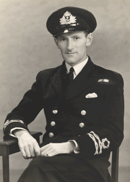
Lt. Commander Thomas H. Shaw, RNR
“I thought this (COPP) was something to do with the pilotage of vessels but, to my horror, found out that the object of COPP was to land on and survey enemy beaches in advance of any landings. However well charted these may be, there was always the possibility, that the beach in question had local obstructions, such as rocks and so on that was not shown on the ordinary chart. No problem for ordinary navigation but for landing craft running on to the beach, very important indeed, if they did not want their bottoms ripped out or severely damaged.
Briefly, each team consisted of two men, one or both being navigating specialists or experts in other fields, who were taken close inshore, usually by submarine. They were dressed like a present day skin-diver, and at the dropping point, paddled to the beach in a folbot (kayak) and the survey carried out. The folbot had to be safely secured and the beach covered on foot by walking up and down, probing for any possible obstructions – [while avoiding detection and avoiding mines].”
Major General Scott-Bowden of COPP told about how Gold Beach the center beach of the five designated landing areas of the Normandy Invasion was surveyed.

Major General Scott-Bowden
“Our mission was to reconnoitre the Gold Beach area around Ver-sur-Mer. Aerial photographs, and some knowledge of local conditions, indicated that just below the sandy top layer were extensive pockets of soft peat which possibly covered clay, and could spell real trouble for tanks and other heavy armoured vehicles. These were possibly the remains of ancient forests, submerged thousands of years ago, and were the focus for our mission.
One dark winter night, Scott-Bowden boarded a motor gunboat at Gosport, with his companion-in-arms Bruce Ogden-Smith. It was vital that all COPP missions were undertaken during the dark phases of the moon, and Winston Churchill apparently suggested the date of December 31, because he believed the German forces would be far too busy celebrating the New Year to notice any activity on the beaches. And he proved to be correct.
A few miles from their target, the two men changed into their bulky rubber swimsuits, and strapped on heavy bandoliers, backpacks, measuring equipment and weapons. They then transferred to a small inshore craft which took them to within a quarter-mile of the beach. After initial problems when they were swept too far east by the currents, they quartered the target beach, taking measurements and core samples with metal augers, storing them in special containers for analysis back in the UK.
Scott-Bowden recalled: “As we swam back through heavy surf towards our rendezvous point, I thought my companion was in trouble, when I heard him shouting. But when I turned to help, he only wished me ‘A Happy New Year’. I told him to, ‘swim you b*****, or we'll land back on the beach’.
A short time later, the Americans asked them to survey their own landing sites during the next dark period, a few weeks later. “This time we boarded an X-craft midget submarine at Gosport, and were towed by Royal Navy trawler to within a few miles of the French coast.
We then spent four days on the seabed, and three nights surveying the beaches to the west of Port-en-Bessin and the Omaha Beach area. When we first approached the target area, we discovered our way was partially blocked by a French fishing fleet, complete with enemy guards. Our Australian skipper, Ken Hudspeth said we could work our way in under the nets, and as we threaded our way through, we raised the periscope.
I was a little surprised to find myself staring into the face of a German soldier, perched close by up on the stern of the last fishing boat, thoughtfully puffing away on a pipe! We downed periscope pretty smartly I can tell you!” By day they surveyed the defences through the periscope, and each night Scott-Bowden and Ogden- Smith donned their cumbersome rubber swimming suits and kit, then swam 400 yards to the shore, all the while dodging the searchlights of the occupying forces.”
Along with the surveying efforts, more than 3,200 aerial reconnaissance missions took place prior to the invasion to acquire photographs of key installations and defences around the five landing beaches. In the run up to D-Day, planes were undertaking 80 sorties a day over the Normandy coast.
On June 6, 1944, the Allied army landed on five beaches along a 50-mile stretch of the heavily fortified coast of France’s Normandy region. More than 5,000 ships and landing craft carrying 156,000 American, British and Canadian forces crossed the Channel to France, and more than 11,000 aircraft were mobilized to provide air cover and support for the invasion. According to some estimates, more than 4,000 Allied troops lost their lives in the D-Day invasion, with thousands more wounded or missing.
We all owe a debt to the surveyors who risked their lives to prepare for the landing at Normandy; without their work, the free world would not be free.
I found a lot of incredibly interesting information about the work of surveyors and engineers preparing for D-Day. These are my sources for this article, but I really only scratched the surface of the subject:

Bird's-eye view of landing craft, barrage balloons, and allied troops landing in Normandy, France on D-Day

Mulberry harbor assembled in preparation for the invasion of Normandy, with military vehicles crossing a floating roadway.
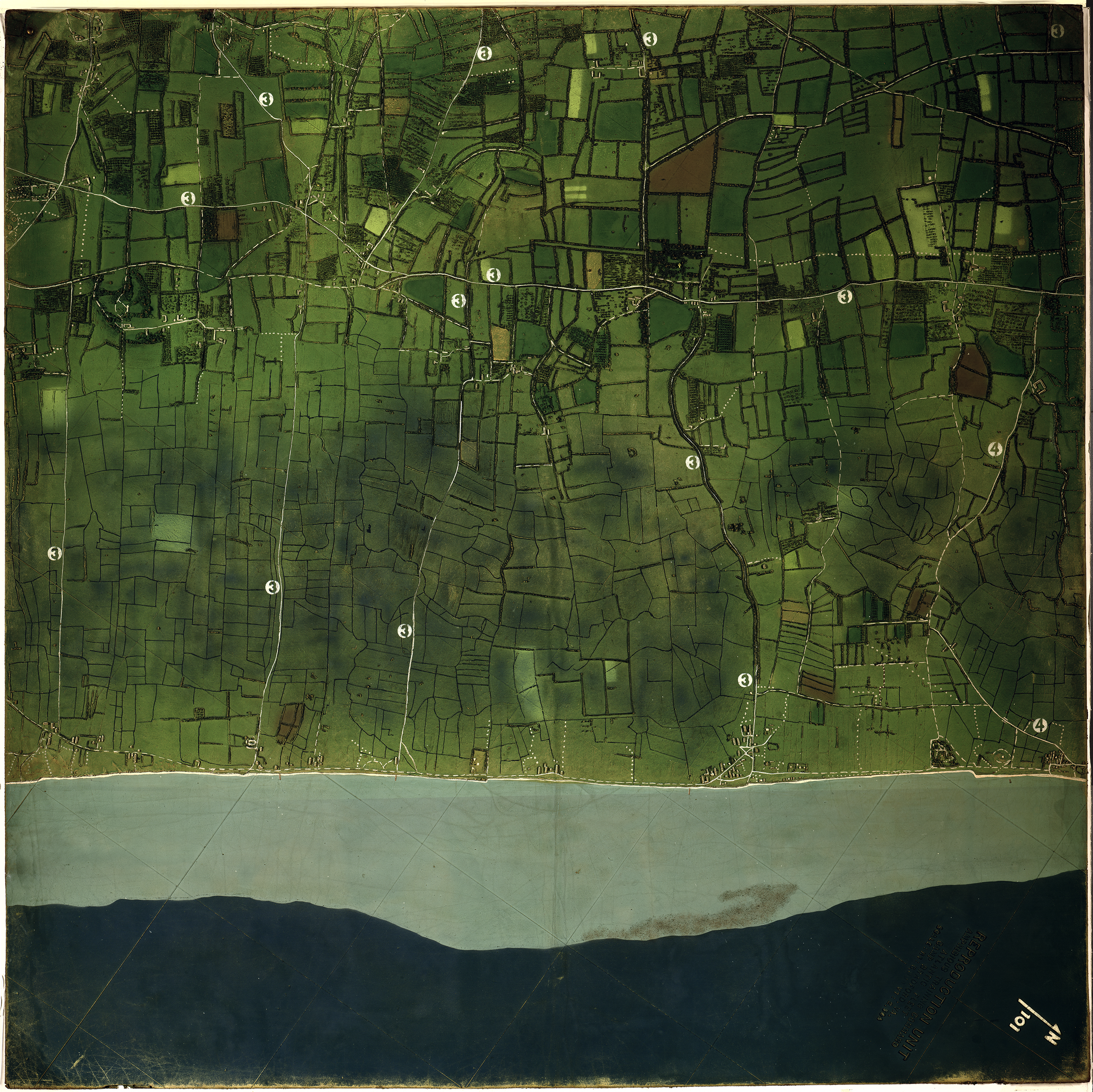
Map of Utah Beach, Normandy, France.
Depth shown by bathymetric tints.
Shows tide lines, slope of the beach, buildings beyond the beach, and the location of hedgehogs (an anti-landing craft system). Numbers on the map correspond with other more traditional maps developed for the invasion.
Created by United States Navy, June 1944 at Camp Bradford, Va.