Ferdinand Vandeveer Hayden and our first national park

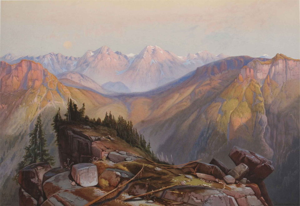
The Canyon of the Yellowstone by Thomas Moran.
Surveyors are natural explorers, so they appreciate and enjoy the beauty and infinite variety of nature every day. Most desk-bound people have to intentionally plan a trip to a county, state or national park. Few are aware that surveyors were instrumental in the creation of our National Parks, including our first – Yellowstone National Park. Back in the 1870s, national parks were a new concept. It took a Herculean effort to make Yellowstone National Park a reality. The land had to be explored, surveyed, catalogued, photographed, and painted so that Congress and the public could get a glimpse of the beauty, grandeur and natural wonders that could be preserved for everyone, forever – as a National Park.
In the 1860s, as part of the westward expansion after the Civil war, the US Government launched several expeditions to explore the American West to learn about the potential minerals, farmland, timber, and other resources that could be used to build the country. Ferdinand Vandeveer Hayden was put in charge of the Geological Survey of the Territories, which focused on the Rocky Mountain region.
Hayden was a geologist, naturalist, teacher, writer, and medical doctor.
Improbable Scientist

Ferdinand Vandeveer Hayden in a rarely-worn suit, circa 1873.
Considering Hayden’s rough start to life, his accomplishments are truly amazing. When he was ten, his father passed away due to alcoholism and his mother sent him away to live with his aunt in Rochester, Ohio. Under his aunt’s care, he flourished. At 21, he was able to attend Oberlin College and enter its Theological Department in 1850. By the next year, his consuming interest in geology and natural history led him to Cleveland to study medicine and natural history.
By 1853, he had embarked on his first field trip as a naturalist as part of a crew that was exploring the area from the Missouri River to the Badlands, and in 1854, he and his partners discovered the first dinosaur remains in America in the Upper Missouri Basin.
In 1861, he enlisted in the Union army and ultimately became a surgeon and Chief Medical Officer of the Army of the Shenandoah during the Civil War. After the war in 1865, he was appointed professor of mineralogy and geology at the University of Pennsylvania and the next year completed an expedition to the upper Missouri basin for the Philadelphia Academy of Sciences.
The next year, he was appointed to lead the Geological Survey of the Territories. The Survey was massive in scope, including geology, natural history, climatology, resources, and ethnology of the region. Each year he submitted a detailed report of the exploration, and each year he added capability to his exploration, eventually including geography, botany, and zoology. He was so interested in fossils that he became known to the Sioux as "man-who-picks-up- stones-running."
Beauty and Danger
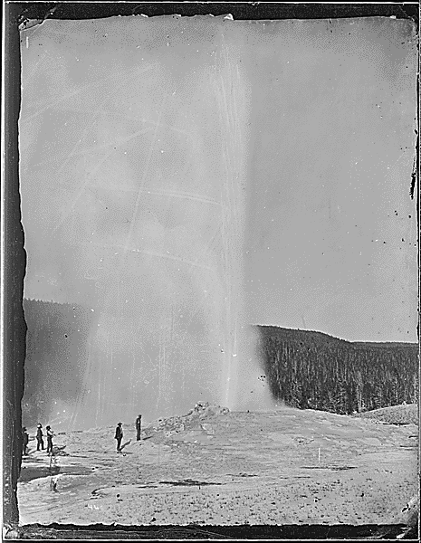
Hayden and his party were fascinated by geysers and "boiling springs" and gave them names such as Thud Geyser, Mud Puff, Architectural Fountain, Catfish, the Bathtub, Dental Cup, Punch Bowl No. 2, and Beehive. They found out the hard way that exploring mud springs and geysers was hazardous – and painful experience, as Hayden wrote:
"The entire surface is perfectly bare of vegetation and hot, yielding in many places to slight pressure. I attempted to walk about among these simmering vents, and broke through to my knees, covering myself with hot mud, to my great pain and subsequent inconvenience."

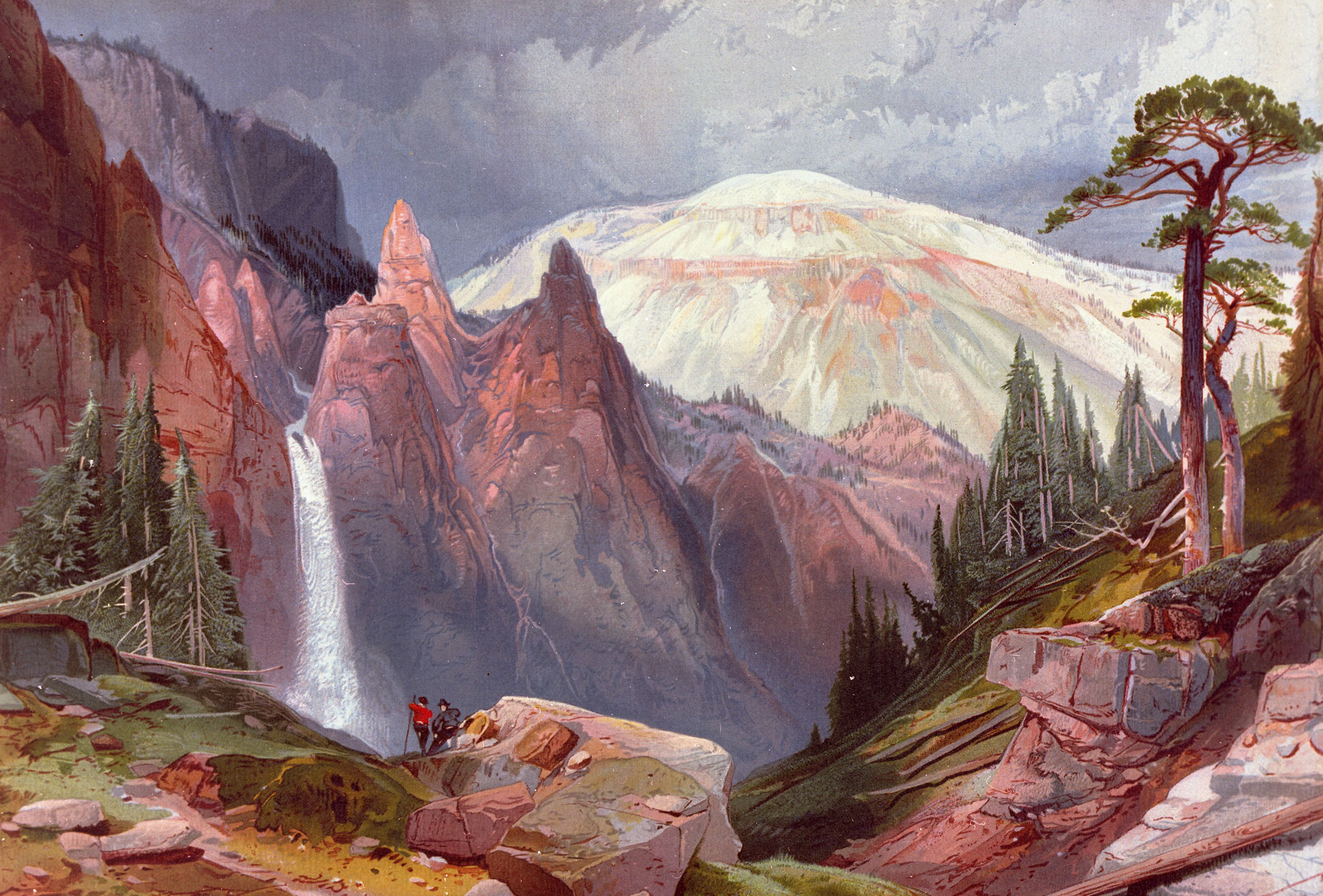
The Great Blue Springs of the Lower Geyser Basin, Thomas Moran, 1874
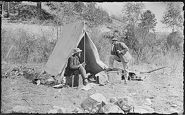
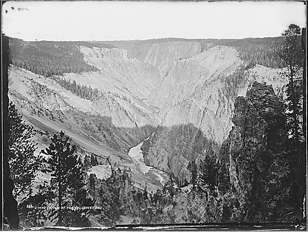
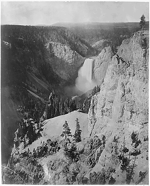
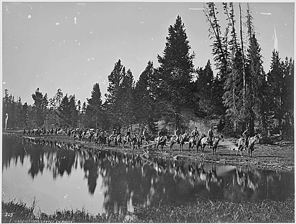
Photographic Images from Hayden’s Yellowstone Survey in 1871 and 1872.
Our First National Park
In 1871-2, Hayden presented this report, the photos, sketches, and paintings to Senators, Congressmen, his superiors in the Department of the Interior, and nearly everyone else who could possibly influence the founding of a park. He also published articles in magazines with national circulation and spent much personal time and effort trying to convince Congress to establish the park.
The reports and images were so compelling that Congress approved legislation for the park in 1872 and President Grant signed it into law, creating 2.2 million acres of land as “a public park or pleasuring-ground for the benefit and enjoyment of the people.” The Secretary of the Interior was responsible for “the preservation, form injury or spoilation, of all timber, mineral deposits, natural curiosities, or wonders within said park, and their retention in their national condition.”
Hayden's surveys were absorbed into the U.S. Geological Survey (USGS) in 1879. Hayden continued to work as a staff geologist in based in Washington. When his health began to deteriorate, he was assigned to the USGS office in Montana – it was thought that being out west would improve his health. By 1886, it became obvious that his health was not improving, and he was forced to resign his position. He returned to Philadelphia where, after being confined to his home for more than a year, he died on December 22, 1887.
Hayden dedicated his life to preserving the incredible natural wonders of Yellowstone. His pioneering work provided the opportunity for 4,860,000 people to visit the park in 2021.
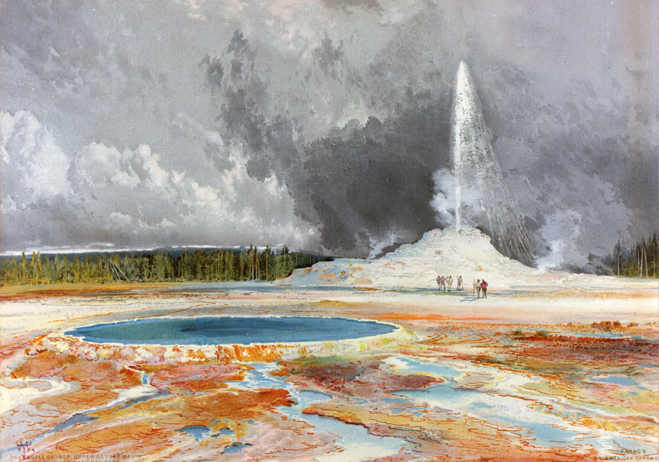
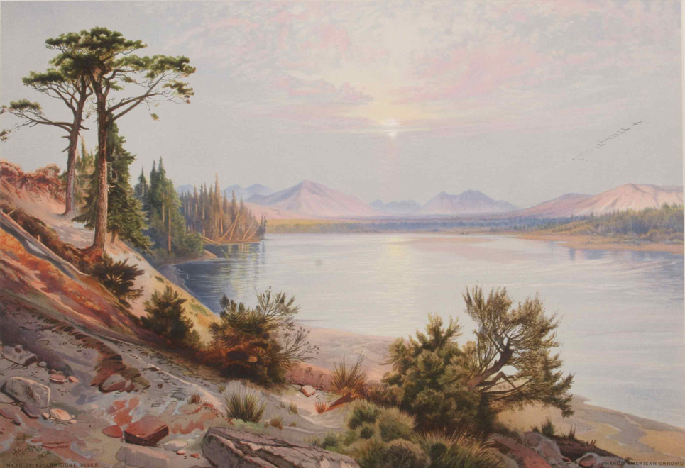
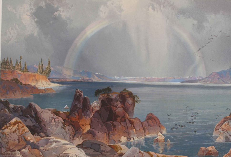
Paintings of Yellowstone by Thomas Moran
The national parks of today are public resources for recreation, education, study, and the preservation of endangered landscapes, natural communities, and species. They exist in twenty-five states as well as the Virgin Islands and include areas as diverse as the "river of grass" that makes up the Everglades, the mountains and valleys of Yosemite, the volcanoes of Hawaii, and the Denali Wilderness of Alaska. Some of them were purchased by private individuals who then generously gave them to the nation; others were taken from the public domain to protect them from development.
An important part of each national park's story is reflected in its maps and surveys. Each park went through the initial stage of discovery, then exploration, and finally accurate mapping. In the first stages, physical and cultural features were often inaccurately portrayed and some were completely absent from the earliest maps.
Government mapping, frequently beginning in the discovery and exploration phase, provided an increased understanding of the unique features of an area, such as the locations of bodies of land and water, topographic and geological attributes, and the presence of historic and cultural artifacts.
Berntsen monuments and markers have been used by the Department of Interior and Park Service for more than 50 years to help them fulfill their mission to make the parks more accessible all Americans. Wherever you enjoy a National Park, Berntsen’s durable trail posts, signs and path markers help make that experience better.
Sources:
https://www.nps.gov/museum/exhibits/thomas_moran/img_gallery.html
https://siarchives.si.edu/featured-topics/megatherium/ferdinand-vandeveer-hayden
https://www.docsteach.org/documents/document/grand-canyon-of-the-yellowstone
http://plainshumanities.unl.edu/encyclopedia/doc/egp.pe.033
https://www.geosociety.org/gsatoday/archive/31/12/pdf/i1052-5173-31-12-20.pdf
https://www.encyclopedia.com/history/encyclopedias-almanacs-transcripts-and-maps/hayden-ferdinand-v
https://www.lindahall.org/about/news/scientist-of-the-day/ferdinand-hayden
http://www.famousamericans.net/ferdinandvandeveerhayden/